|
Project Overview
Full Title
ALBE NAWQA
Location
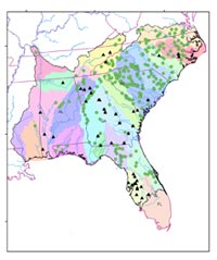
 Souteastern United States Souteastern United States
Project Chief
Douglas Harned
Period of Project
2001-2010
Team Members
Melinda Chapman
Michelle Moorman
Thomas Cuffney
Ana María García
Gerard McMahon
Eric Staub
Silvia Terziotti
USGS IN YOUR STATE
USGS Water Science Centers are located in each state.

|
Albemarle-Pamlico NAWQA
2 - Major River Basin 2 study (MRB2):
SPARROW
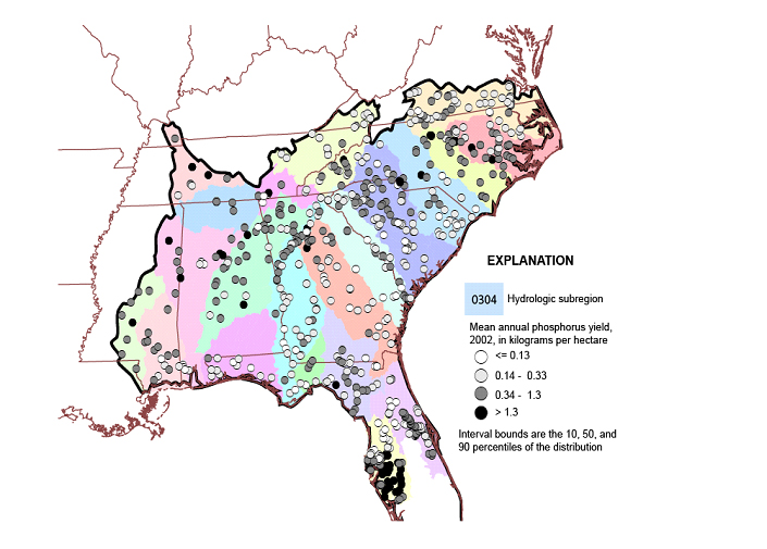
Figure 1. Observed total phosphorus loads at water-quality monitoring sites used to calibrate the SPARROW model
Efforts to reduce phosphorus losses and limit eutrophication of nutrient-sensitive water bodies have prompted an interest in modeling frameworks that can be used to assess phosphorus transport and the effect of management practices. The SPARROW (SPAtially-Referenced Regression on Watershed attributes) model was developed to study linkages between monitoring data and watershed factors that determine water quality at a regional scale. It consists of a nonlinear regression equation describing the transport of contaminants from point and non-point sources on land to rivers and through the stream and river network.
The model is being applied to major river basins in the Southeast to estimate rates of transport and delivery of phosphorus as a function of landscape and channel characteristics. The model framework is based on 1:500,000-scale hydrography. Loads are being correlated to upstream sources, such as point discharges, fertilizer and manure application rates, and natural or background phosphorus sources. Delivery rates were correlated to watershed factors that influence phosphorus transport, including precipitation, soil characteristics, stream density and conservation practices such as the extent of tillage and buffers. The results describe the proportional contribution to stream phosphorus load from different sources, as well as the proportion of phosphorus load from each watershed that reaches nutrient-sensitive water bodies and coastal areas, and attenuating factors.
Publications:
Hoos, Anne B., Terziotti, Silvia, McMahon, Gerard, Savvas, Katerina, Tighe, Kirsten C., Alkons-Wolinsky, Ruth, 2008, Data to Support Statistical Modeling of Instream Nutrient Load Based on Watershed Attributes, Southeastern United States, 2002 , US. Geological Survey Open File Report 2008-1163, 51 p.
|

