South Atlantic Water Science Center - North Carolina Office
|
Project OverviewFull Title Location Cooperating Agencies Project Chief Period of Project Team Members USGS IN YOUR STATEUSGS Water Science Centers are located in each state. 
|
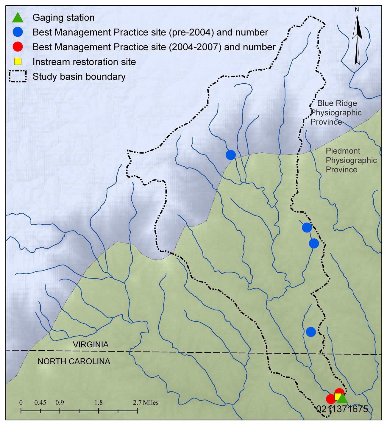
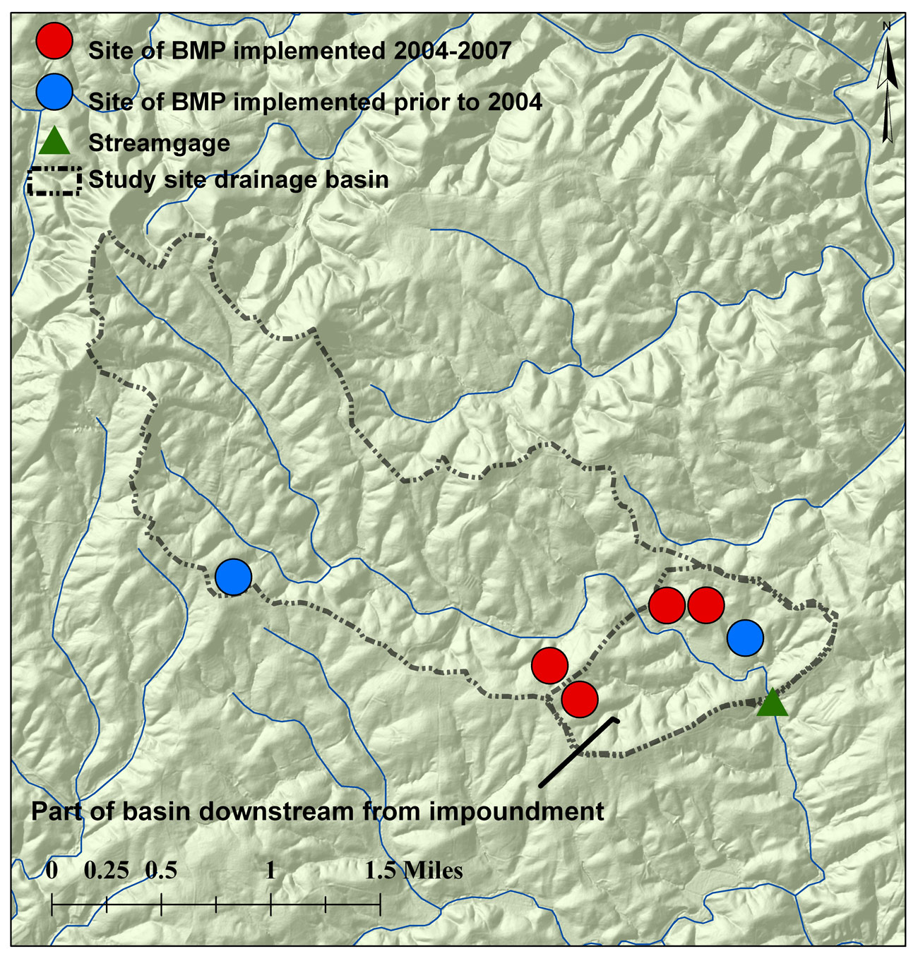
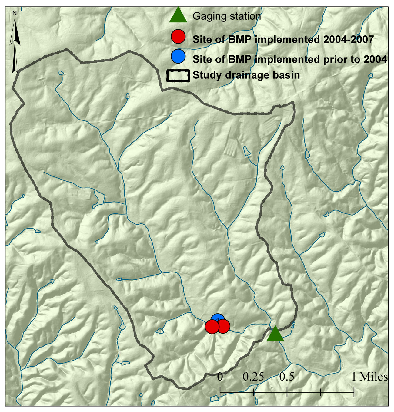
Sediment Collection Surry CountyThis project was completed in 2012. These pages are for historical purposes only. Study AreaSite location map The three study sites are in Surry County, NC, in the Upper Yadkin River basin. Drainage basins of the study sites range in size from 3.3 to 20.7 square miles. The drainage basins of the Bull Creek and Hogan Creek sites are entirely within the Piedmont physiographic province. The drainage basin of the Pauls Creek site, the largest of the study sites, lies primarily in the southern part of Carroll County, Virginia. About a third of the Pauls Creek drainage basin lies within the Blue Ridge physiographic province and the remaining two-thirds of the basin lies within the Piedmont physiographic province. Pasture and hay production were the dominant land uses in the Bull and Hogan Creek basins and represented slightly more than half of the total land area in these basins. Forest was the dominant land use category in the Pauls Creek drainage basin, especially in the parts of the basin within the Blue Ridge physiographic province, and represented more than 60 percent of the land area. Major crops cultivated in the study basins included winter wheat, soybeans, and corn. Urban and residential land uses accounted for about 20.1 and 20.2 percent of the Bull and Hogan Creek basins, respectively, compared to 1.2 percent of the Pauls Creek basin. Pauls Creek (Restoration + BMP site)Map of Pauls Creek basin showing general locations of BMPs and in-stream restoration site The Pauls Creek site was selected to assess the effects of in-stream restoration and BMPs on stream quality. Prior to restoration efforts, stream bank erosion had contributed to loss of riparian vegetation and development of undercut stream banks. Cattle crossing at Pauls Creek site From late October through November 2005, stream banks along a 1,200-foot reach of the Pauls Creek stream channel upstream from the gaging station were stabilized by grading and placement of a series of cross vanes designed to direct flow toward the center of the stream channel. The cross vanes were constructed of large boulders. Two BMPs, one designed to exclude livestock from the stream and the second designed to exclude livestock and decrease stream bank erosion, were implemented during the study in the vicinity of the gaging station at the Pauls Creek site. Two BMPs, primarily designed to decrease erosion through conversion of erodible cropland to forests, and two BMPs designed to exclude livestock from streams were implemented prior to the study in the Virginia part of the basin from 1989 to 2003. Bull Creek (BMP site)In the Bull Creek drainage basin, four agricultural BMPs were implemented during the study and two were implemented prior to the study. Impoundment on Bull Creek upstream from the Bull Creek gaging station at Ash Hill In the Bull Creek drainage basin, four agricultural BMPs were implemented during the study and two were implemented prior to the study. Three of the BMPs implemented during the study were designed to restrict access of livestock to streams. The fourth BMP implemented in the Bull Creek basin involved construction of a lined chicken composter and is unlikely to have affected stream sediment concentrations. Hogan Creek (Control Site)The Hogan Creek basin was used as a control. Although not originally planned, two livestock exclusion BMPs were implemented during the study in May and August 2007. These BMPs were implemented near the end of data collection and effects from these BMPs did not likely affect the suitability of this site as a control site. One BMP was implemented prior to this study.
|

![]() U.S. Department of the Interior |
U.S. Geological Survey
U.S. Department of the Interior |
U.S. Geological Survey
URL: https://nc.water.usgs.gov/projects/surry/maps.html
Page Contact Information:
North Carolina Web Development Team
Page Last Modified: Monday, 05-Dec-2016 11:05:30 EST
