South Atlantic Water Science Center - North Carolina Office
|
Project OverviewFull Title Location Cooperating Agencies Project Chief Period of Project Science Topic USGS IN YOUR STATEUSGS Water Science Centers are located in each state. 
|
Pee Dee National Wildlife Refuge flow modelSummaryBackground 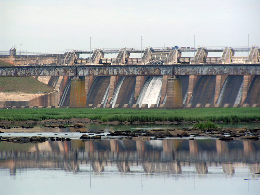
Lake Tillery Dam during low-release volume, August 2009 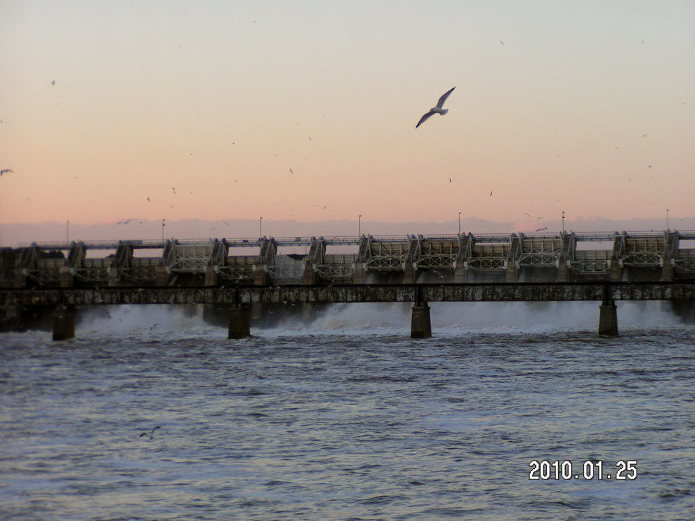
Lake Tillery Dam during high-release volume, January 2010 The Pee Dee National Wildlife Refuge (NWR) is located in North Carolina and includes areas within Anson and Richmond Counties. The Pee Dee NWR covers approximately 8,500 acres of land positioned along or near the Pee Dee River. The Pee Dee NWR was established in 1963 to provide "an inviolate sanctuary … for migratory birds". Fall and winter bird populations can exceed 10,000, including endangered and threatened species. Releases of water from the Lake Tillery dam to the Pee Dee River affect water levels in the Pee Dee NWR. The areas along the river are subject to intermittent inundation due to flooding which can cause damage to sensitive areas and wildlife habitat. The U.S. Geological Survey and the U.S. Fish and Wildlife Service entered into a cooperative agreement to develop a model of streamflow and inundation in the Pee Dee NWR area. The resulting flow model will be used to better understand streamflow and flooding in the area and serve to protect refuge assets and sensitive habitat areas. Objectives The purpose of the project is to develop a model of streamflow and floodplain inundation in the area of the Pee Dee National Wildlife Refuge. The model includes the main channel and associated floodplains of the Pee Dee River from NC Highway 731 to NC Highway 109, the lower mile of the Rocky River, and Brown Creek between US Highway 52 and confluence with the Pee Dee River. (Study Area map) 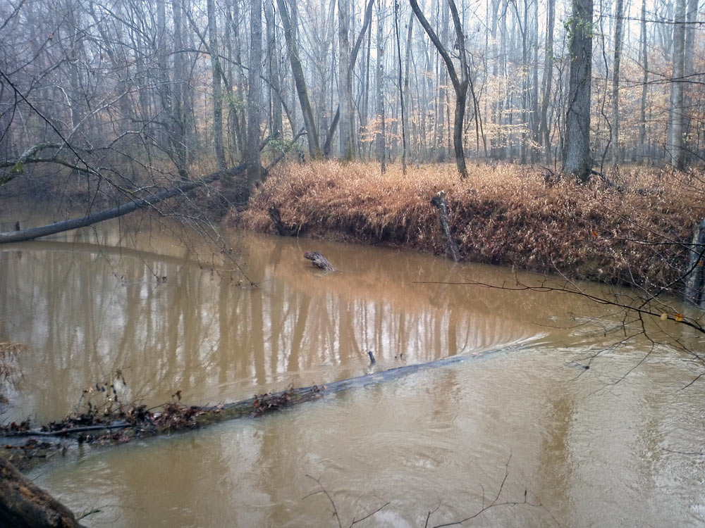
Brown Creek at Pee Dee National Wildlife Refuge, January 2012 Approach Channel bathymetry of the Pee Dee River, Rocky River, and Brown Creek was surveyed at multiple cross-sections using an Acoustic Doppler Current Profiler (ADCP). Elevation data from each cross-section was merged with LiDAR elevation on the floodplains to create a comprehensive Digital Terrain Model of the study area, which was used to generate the underlying model geometry in the Hydraulic Engineering Center’s River Analysis System (HEC-RAS). Stage was monitored at three sites on the Pee Dee River, three sites on Brown Creek and one site on Thoroughfare Creek. These stage data were collected for approximately an 18-month period and used to test and calibrate the model. Additional streamflow data available from an existing gaging station on the Pee Dee River at NC Highway 731 upstream from the Refuge and from an existing gaging station on Rocky River also was used in model development and calibration. The results of this project will be presented in a report published online through the USGS North Carolina Water Science Center's website. |

![]() U.S. Department of the Interior |
U.S. Geological Survey
U.S. Department of the Interior |
U.S. Geological Survey
URL: https://nc.water.usgs.gov/projects/peedee_model/summary.html
Page Contact Information:
North Carolina Web Development Team
Page Last Modified: Monday, 05-Dec-2016 11:05:00 EST
