South Atlantic Water Science Center - North Carolina Office
|
Project OverviewFull Title Location Cooperating Agencies Project Chief Period of Project Science Topic USGS IN YOUR STATEUSGS Water Science Centers are located in each state. 
|
Pee Dee National Wildlife Refuge flow modelIntroduction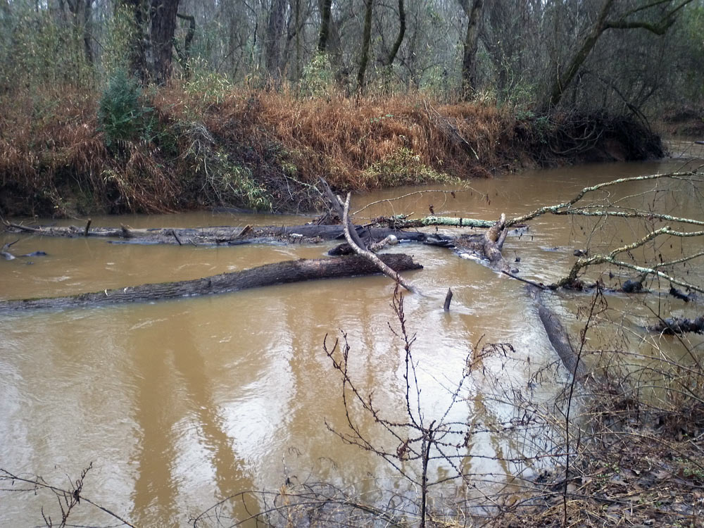
Downed trees in Brown Creek at Pee Dee National Wildlife Refuge, January 2012 The Pee Dee National Wildlife Refuge (NWR) is located in North Carolina and includes areas within Anson and Richmond Counties. The Refuge is managed by the U.S. Fish and Wildlife Service and covers approximately 8,500 acres of land positioned along or near the Pee Dee River. The refuge is located about 8 miles downstream from the Lake Tillery dam. The Lake Tillery dam is used for flood control and hydroelectric power generation. Releases of water from the dam to the Pee Dee River affect water levels within the Pee Dee NWR. Areas along the river are subject to intermittent inundation due to flooding which can damage sensitive biota and wildlife habitat. The depth, duration and extent of floodplain inundation affects accessibility to the refuge, habitat use and reproductive success of wildlife, and regeneration of bottomland hardwood trees, and must be considered in land-use and program development decision making by the Pee Dee NWR managers. The relation between dam releases, river flow and floodplain water levels in the Pee Dee NWR is important but poorly understood. Understanding the current hydrologic regime of the Pee Dee NWR is critical for focusing management efforts to respond and adapt to periods of inundation. Resource managers have a need for improved management tools that will provide advance knowledge of potential flooding and provide a means to plan effective responses to periods of inundation so that natural and man-made assets may be protected. |

![]() U.S. Department of the Interior |
U.S. Geological Survey
U.S. Department of the Interior |
U.S. Geological Survey
URL: https://nc.water.usgs.gov/projects/peedee_model/index.html
Page Contact Information:
North Carolina Web Development Team
Page Last Modified: Monday, 05-Dec-2016 11:04:59 EST
