Surface Water Levels
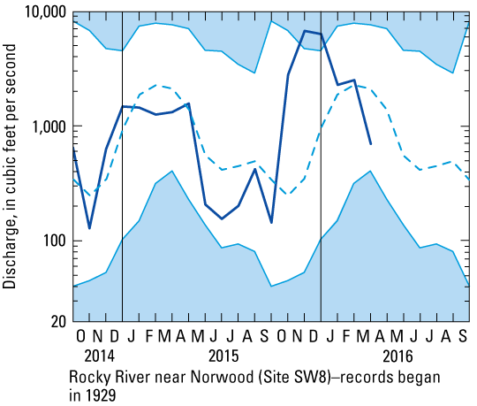
Rocky River near Norwood (Site SW8)

Monthly mean flow for March 2016 is 710 cfs
Explanation
 Unshaded area indicates range between highest and lowest record for the month. Unshaded area indicates range between highest and lowest record for the month.
 Dashed line indicates median monthly mean streamflow. Dashed line indicates median monthly mean streamflow.
 Heavy line indicates monthend levels for current period. Heavy line indicates monthend levels for current period.
This data is provisional and is subject to revision.
|