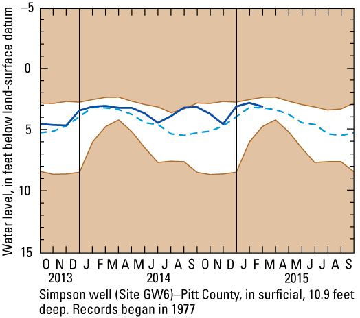
Ground Water Levels
Simpson Well (Site GW6)

Depth below land surface for February 2015 is 3.04 feet.
Explanation
 Unshaded area indicates range between highest and lowest record for monthly mean water levels. Unshaded area indicates range between highest and lowest record for monthly mean water levels.
 Dashed line indicates the median monthly mean water levels. Dashed line indicates the median monthly mean water levels.
 Heavy line indicates current monthly mean water levels for current period. Heavy line indicates current monthly mean water levels for current period.
The purpose of the ground-water hydrographs is to illustrate climatic effects on water-level conditions in shallow aquifers.
This data is provisional and is subject to revision.
|