South Atlantic Water Science Center - North Carolina Office
Project OverviewFull Title Location Cooperating Agencies Project Chief Period of Project Team Members USGS IN YOUR STATEUSGS Water Science Centers are located in each state. 
|
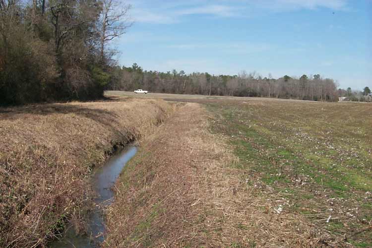
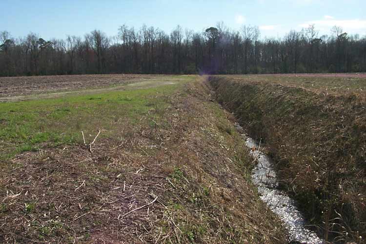
Artificial DrainageThis project was completed in 2001. These pages are for historical purposes only. Project SummaryAgricultural field with drainage improvement Background In North Carolina, about 40 percent of the cropland requires drainage improvements to increase agricultural production in poorly drained soils. A common practice for improving drainage is to install ditches (Pictures 1, 2) and subsurface tile drains (Pictures 3, 4) to lower the water table beneath agricultural fields. These drainage improvements increase the amount of land available for cultivation; however, the process of redirecting shallow ground water beneath agricultural fields through tile drains to ditches can alter the quality of drainage water exiting the fields to receiving streams. Nitrate-nitrogen (NO3) concentrations ranging from about 5 to 50 milligrams per liter (mg/L) in tile drainage water have been noted in various studies. In eastern North Carolina, excessive nutrient loadings have contributed to the degradation of surface-water quality in the Neuse River basin. The North Carolina Environmental Management Commission adopted rules in 1997 to reduce nitrogen loads in the Neuse River by 30 percent to support the Neuse River Nutrient Sensitive Waters Management Strategy. For agricultural land, several combinations of best management practices (BMPs), including nutrient management, controlled drainage, forested riparian buffers, and vegetative filter strips, were proposed for reducing nutrient loads. Because tile drains and ditches are constructed channels that artificially intercept the water table, they can allow ground water containing agricultural chemicals beneath cultivated fields to bypass natural streamside buffers and organic carbon-rich streambeds that normally would reduce NO3 in the ground water before it discharges to streams. Subsurface tile drains are considered a major pathway for NO3 transport to surface water in some agricultural watersheds.
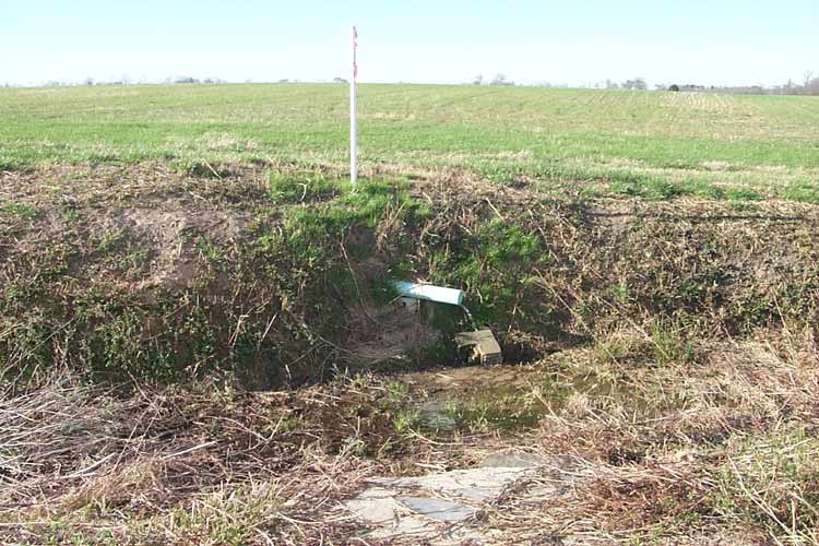
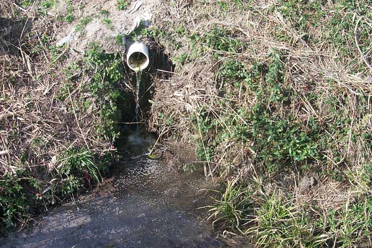
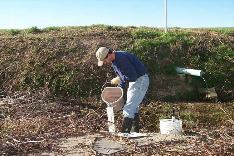
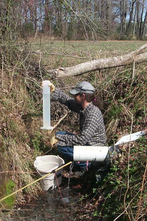
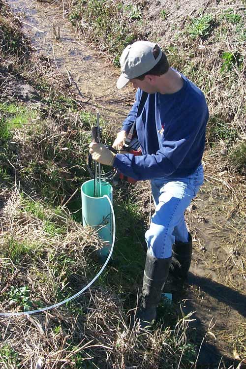
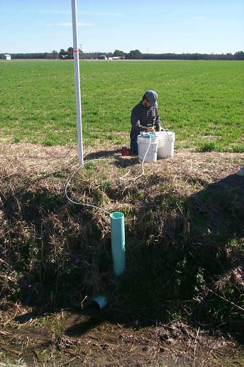
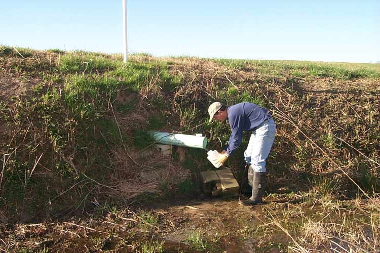
Objectives This study was conducted to characterize the quality of drainage water in tile drains and ditches with respect to different agricultural settings in a low-gradient, organic rich, coastal plain watershed. Information obtained from this study is intended to provide a better understanding of the effects of land-management practices on nutrient loadings associated with artificially drained farmland and to assist water-resource managers in determining priorities for effective management of nutrient-reduction strategies. Approach The study area is in the Middle Swamp watershed of the Neuse River basin in the North Carolina Coastal Plain (fig. 1). Discharge measurements and water-quality samples were collected at study sites (table 1) from August 2000 to August 2001 to evaluate water-quality conditions in relation to different nitrogen fertilization practices used in the study area. Agricultural fields with existing ditches and(or) tile drains and in which different sources of nitrogen fertilizer were applied to row crops were selected for study. The three types of fertilizer applied to study sites include commercial inorganic fertilizer, sprayed swine-lagoon effluent, and wastewater-treatment plant sludge. Discharge measurements at tile-drain outlets were determined primarily by using volumetric methods (Pictures 5, 6). In some cases, the tile pipes were modified to permit the use of velocity meters to obtain discharge data (Picture 7). Discharge measurements at ditch sites also were determined by using a velocity meter. Water-quality samples were collected from ditches and tile drains (Pictures 8, 9) and analyzed for nutrients, anions, and cations.
Progress (January 2004) The final report for this investigation has been completed and submitted to a journal for peer review. |
|||||||||||||||||||||||||||||

![]() U.S. Department of the Interior |
U.S. Geological Survey
U.S. Department of the Interior |
U.S. Geological Survey
URL: https://nc.water.usgs.gov/projects/tile_drains/overview.html
Page Contact Information:
North Carolina Web Development Team
Page Last Modified: Monday, 05-Dec-2016 11:05:44 EST
