Latest Information
Study Overview
The objective of this study is to develop a county-wide assessment of groundwater availability within the fractured-rock aquifer system in Wake County that will prepare the County for planning into the future. The goal is to develop a comprehensive groundwater budget for the county, including sources and distribution of water into the system and out of the system. Since fractured rock aquifers dominate the landscape, key tasks include characterization of the fractured rock aquifers. The study will assist Wake County in the management of their groundwater resources by providing information on sustainable quantity of groundwater, which will be based on water-budget components including potential recharge, distribution of well yields, and locating possible instances of well interference and competing uses.
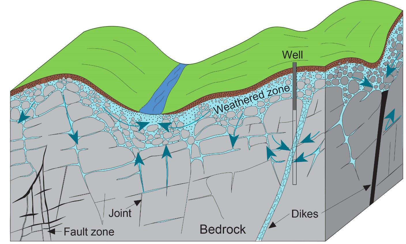
Generalized groundwater flow in a fractured-rock aquifer
(modified from Freeze and Cherry, 1979)
Project Tasks
- Implement a groundwater-level monitoring network for Wake County.
- Collect borehole geophysical logs within the monitoring network wells.
- Map the distribution of maximum well-yields and primary fracture orientations.
- Display the spatial distribution of natural recharge to the groundwater system using a Soil and Water Balance model.
- Estimate the groundwater contribution to streamflow at gaged-streams using hydrograph-separation analyses.
- Future Land-use and water demand forecast modeling.
- Simulate regional groundwater flow using MODFLOW model.
- Summarize all data collected and assess the County’s groundwater resources in two USGS Scientific Investigations Reports.
Geologic Map of Wake County
(Credit: North Carolina Geologic Survey)