Synoptic groundwater-levels
The USGS will collect synoptic water-levels from residential wells and monitoring wells across Wake County in the Spring and Fall of 2020. The water-level collection effort will provide a “snapshot” of groundwater conditions within the aquifer that are measured within a relatively short period during the wet and dry seasons. The data are needed for mapping the elevation of the water table or potentiometric surface, determining hydraulic gradients, or defining the physical boundaries of an aquifer. These regional synoptic measurements will complement more frequent measurements made from the Wake County monitoring network wells and help develop the groundwater flow model.
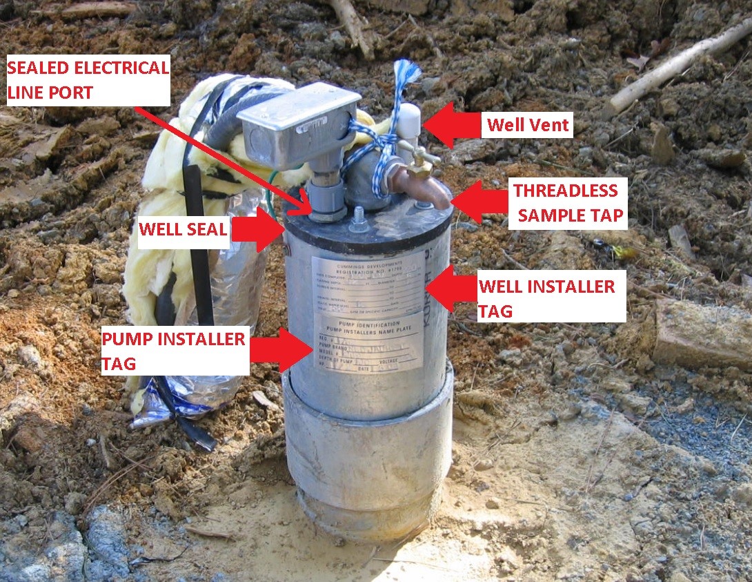
Well Head (Credit: Wake County Environmental Services)
Water-levels will be collected using a calibrated steel tape or sonic water-level meter from the vent port on the well head at residential wells.
Water-quality, stable isotopes, age-dating tracers
Sites will be sampled for major ions, water isotopes deuterium and oxygen-18, and groundwater-age dating tracers, such as tritium, helium, and chlorofluorocarbons. Distinguishing isotopic signatures of groundwater, surface water, and rainfall can help define the sources of groundwater recharge. The presence of age-dating tracers in the groundwater tell us how young the water is. Tritium was released into the atmosphere by detonation of nuclear bombs in the 1950s and early 1960s, and chlorofluorocarbons (CFCs) were released into the atmosphere from refrigeration and other uses from the 1930s through the 1980s. These can be used to estimate recharge rates, aquifer vulnerability, and used as calibration targets in groundwater-flow models.
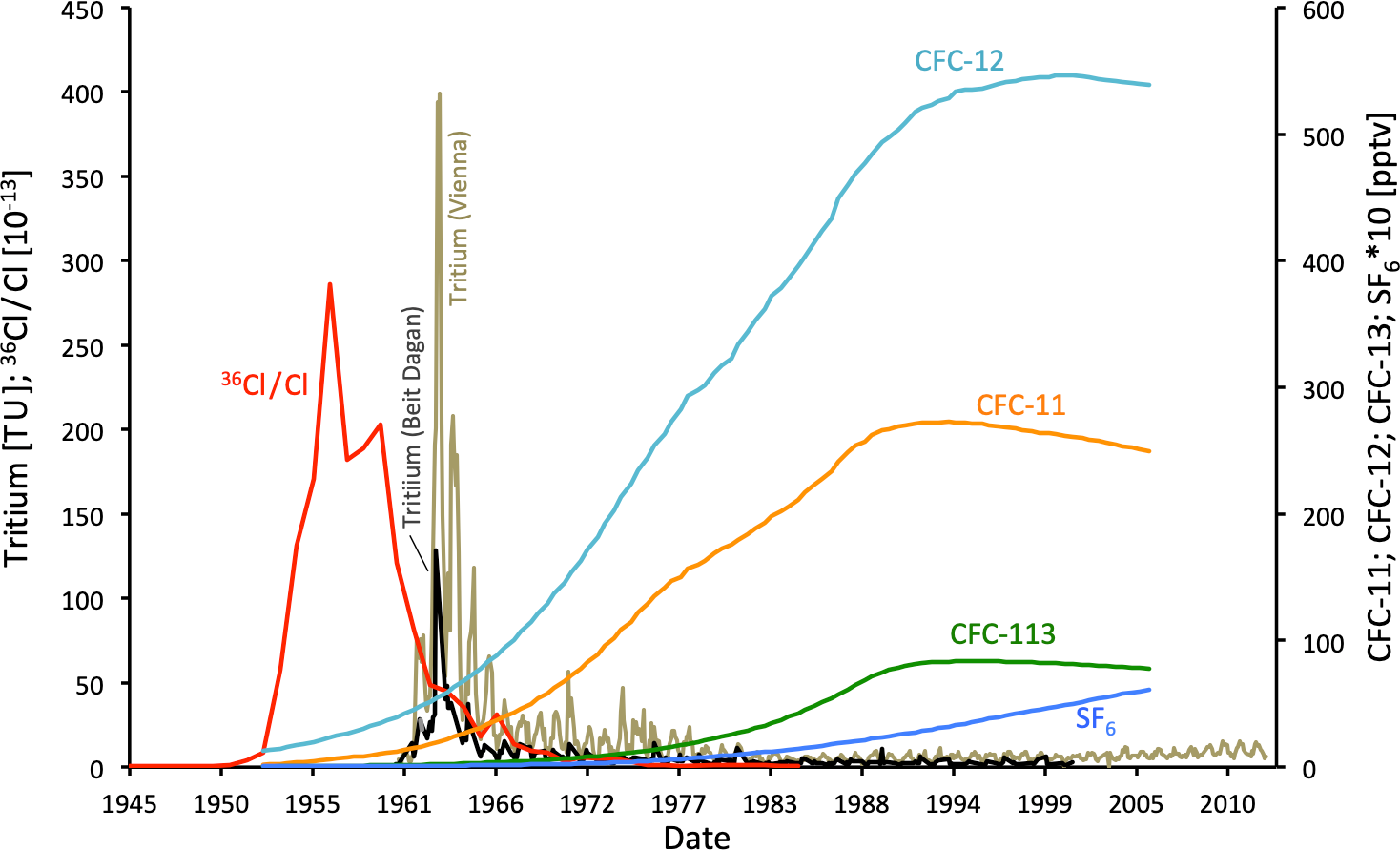
Atmospheric input curves of 36Cl ∕ Cl (36Cl obtained from Dye-3 ice core; Synal et al., 1990), SF6 and CFCs (Plummer et al., 2006) and decay-corrected Tritium in rain water of Beit Dagan and Vienna (IAEA/WMO, 2019)
Geophysical Logging
Lithologic and subsurface structure data will be collected using geophysical borehole logs including the use of caliper, natural gamma, spontaneous potential, long and short normal resistivity, fluid temperature and conductance, optical-televiewer (OTV) and acoustic-televiewer (ATV) imaging, and heat-pulse flowmeter logs (under ambient and pumping conditions).
Archived geophysical logs collected for the project will be publicly available via the USGS GeoLog Locator link: https://webapps.usgs.gov/GeoLogLocator/#!/search

Geophysical logs and interpreted fractures in bedrock well WK-283 at the Raleigh hydrogeologic research station, Wake County, North Carolina (click image for detailed viewing)
Maximum well-yield map
Well-yields, derived from compiled well construction and permit information, will be compared with regional lithologic and hydrogeologic information to assess patterns that could be used to estimate well-yields in areas of the county where there are few data points. A well-yield map will be developed for Wake County showing the spatial distribution of estimated maximum well-yields.
Baseflow estimation from hydrograph separation methods at streamflow gages
Watersheds within and surrounding Wake County will be analyzed by hydrograph separation, a technique that allows separation of the surface runoff and groundwater runoff components of existing streamflow hydrographs.