South Atlantic Water Science Center
South Atlantic Water Science Center
![]()
Full Title
Hydraulic Modeling for Management Application at Pee Dee National Wildlife Refuge
Location
![]() Anson and Richmond Counties
Anson and Richmond Counties
Cooperating Agencies
U.S. Fish and Wildlife Service
Project Chief
Doug Smith
dgsmith@usgs.gov
Period of Project
2011 - 2013
Science Topic
Hydrologic and Geospatial data
Hydrologic Hazards

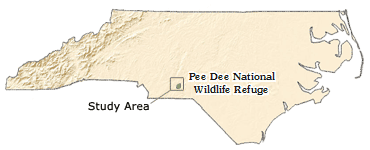
Location of study area and Pee Dee NWR in North Carolina
As part of the study, stage was continuously measured at one site on Brown Creek and two sites on the Pee Dee River. Partial records of stage were recorded for high-flow conditions at two additional sites on Brown Creek, one site on Thoroughfare Creek and one additional site on the Pee Dee River. Existing USGS streamgages on the Pee Dee River directly downstream of Lake Tillery and on the Rocky River near Norwood, NC were also utilized in the study. Data from all of these sites were used for model development and calibration.
| Map Symbol |
Map Number |
Station Number |
Station Name | Data type | Period of Record | Drainage Area (mi2) |
Latitude | Longitude |
| 1 | 0212378405 | Pee Dee River at NC Hwy 731 near Ansonville, NC | Existing continuous stage data | 3/2009 to present | 4,694 | 35° 12' 02.4" | 80° 03' 42.5" | |
| 2 | 02126375 | Pee Dee River at Pee Dee Refuge near Ansonville, NC | Continuous stage data | 8/2011 to present | 6,130 | 35° 06' 11.58" | 80° 02' 45.36" | |
| 3 | 02126395 | Pee Dee River above Brown Creek near Ansonville, NC | Partial-record stage data | 8/2011 to 8/2013 1 | 6,140 | 35° 05' 25.92" | 80° 01' 21.38" | |
| 4 | 02127500 | Pee Dee River at NC Hwy 109 near Ansonville, NC | Continuous stage data | 11/2011 to 8/2013 | 6,320 | 35° 05' 07" | 79° 59' 57" | |
| 5 | 02127318 | Brown Creek at US Hwy 52 near Ansonville, NC | Continuous stage data | 11/2011 to 8/2013 | 152 | 35° 04' 04" | 80° 05' 54" | |
| 6 | 02127422 | Brown Creek at Bennett Bridge near Ansonville, NC | Partial-record stage data | 8/2011 to 8/2013 1, 2 | 163 | 35° 03' 48.43" | 80° 03' 10.61" | |
| 7 | 02127461 | Brown Creek at Grassy Island Road near Ansonville, NC | Partial-record stage data | 4/2012 to 8/2013 1 | 179 | 35° 04' 51" | 80° 01' 34" | |
| 8 | 02126385 | Thoroughfare Creek near Ansonville, NC | Partial-record stage data | 8/2011 to 8/2013 1 | 0.57 | 35° 05' 36.62" | 80° 02' 49.42" | |
| 9 | 02126000 | Rocky River near Norwood, N.C. | Existing continuous stage and streamflow data | 10/1929 to present | 1,372 | 35° 08' 56" | 80° 10' 33" |
1 Period of record for partial-record sites indicates the dates equipment was installed and removed for this project. These stations were used to record high-flow conditions only, so there are limited recorded data points at each station. Data will be published in the final report.
2 Station 02127422, Brown Creek at Bennett Bridge near Ansonville, had been operated as a partial record station prior to this project. Periodic discharge measurements made at this site from 1985 to 1995 were used in model development and calibration.