
South Atlantic Water Science Center
South Atlantic Water Science Center
![]()
Full Title
Rating Unsaturated Zone and Watershed Characteristics of Public Water Supplies - 2009 Updates
Location
![]() Statewide
Statewide
Cooperating Agencies
Public Water Supply Section
Source Water Assessment and Protection Program
Project Chief
Silvia Terziotti
seterzio@usgs.gov
Period of Project
1/2009 - 6/2009
Team Members
Kirsten Tighe
Ramona Traynor
This project was completed in 2009. These pages are for historical purposes only.
| Unsaturated Zone |
|---|
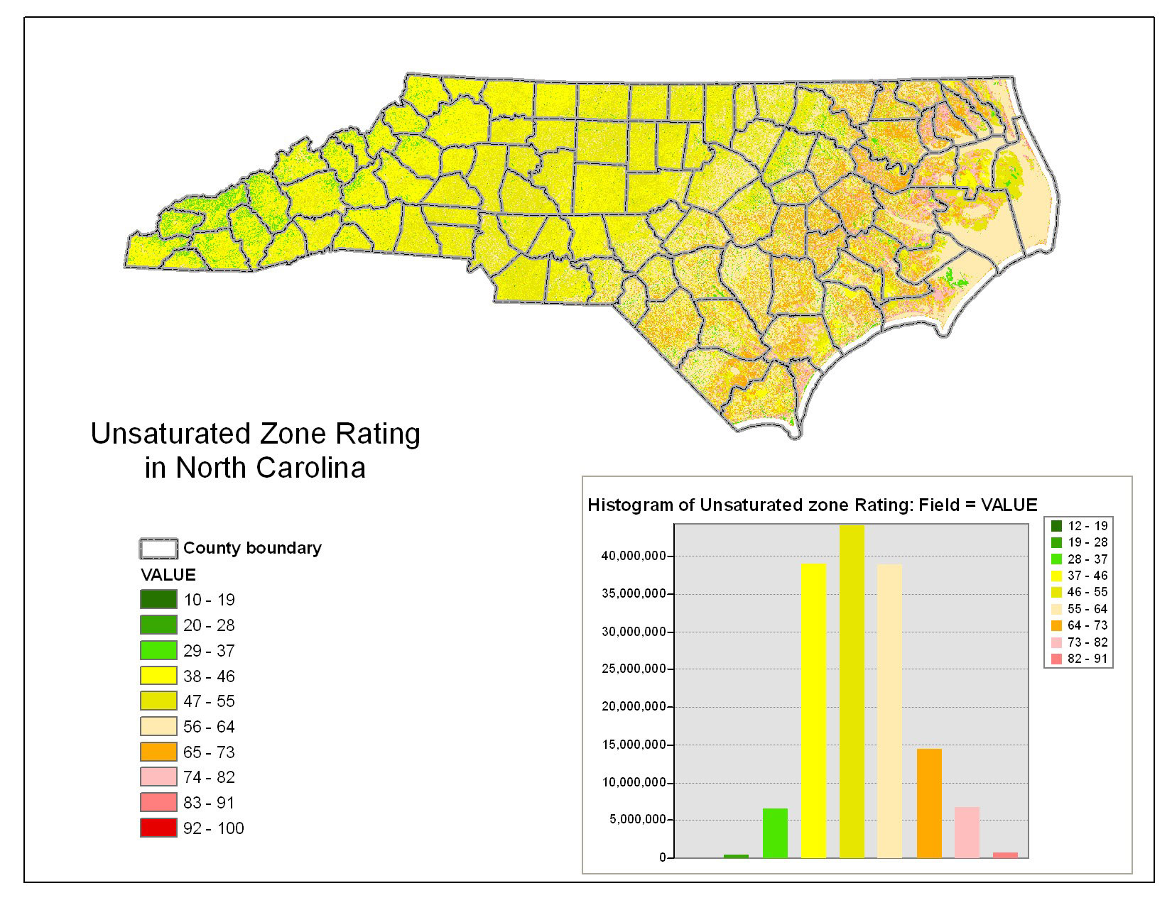
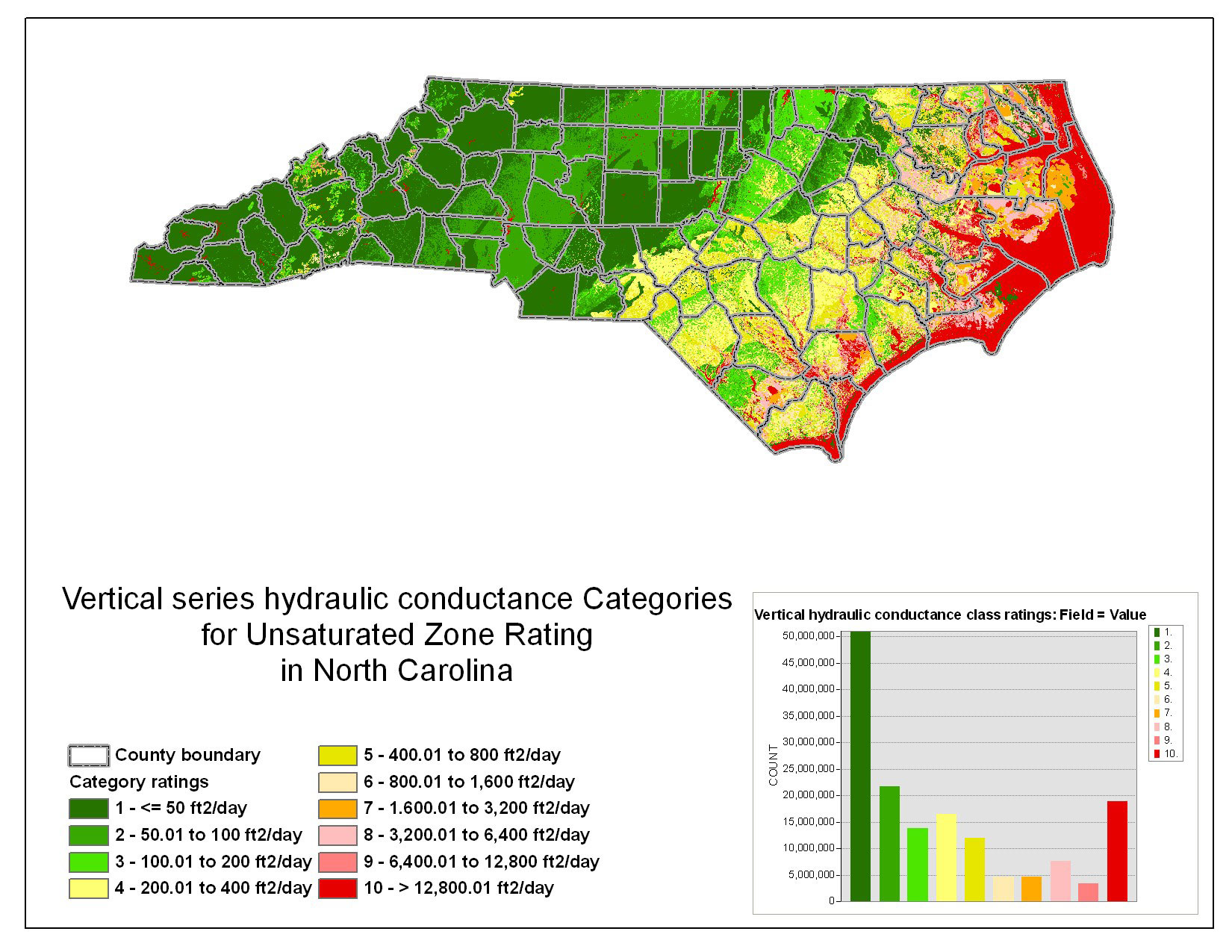
Unsaturated Zone Rating |
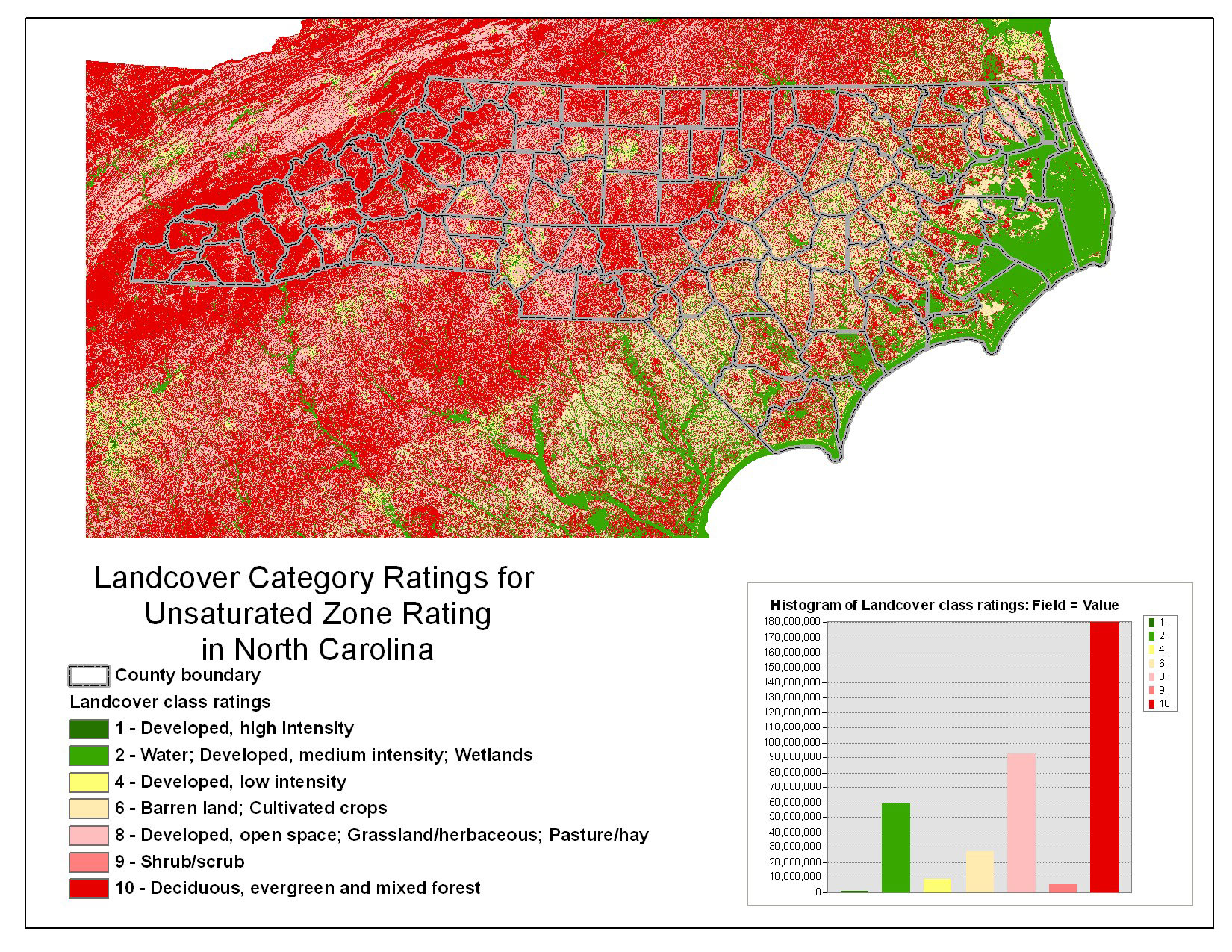
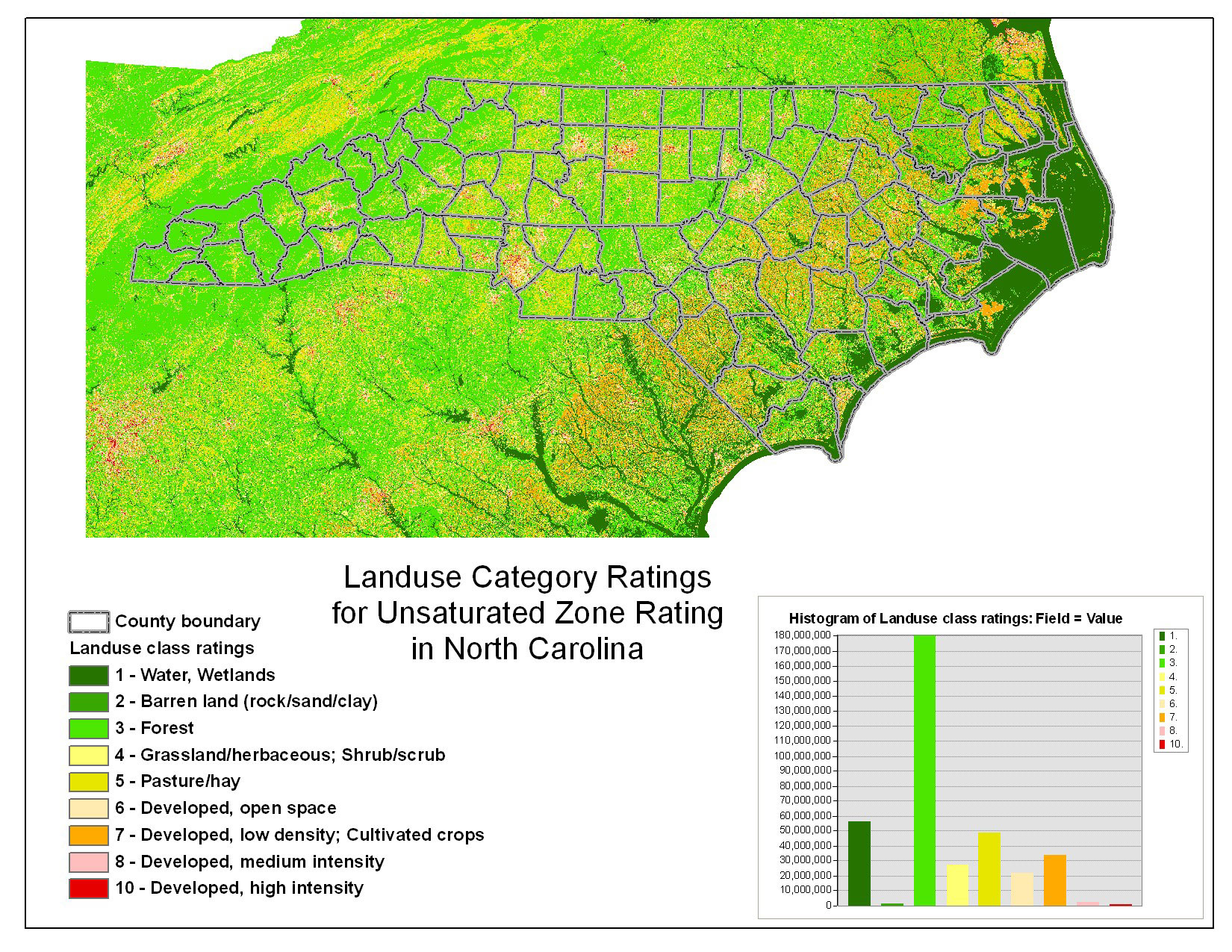
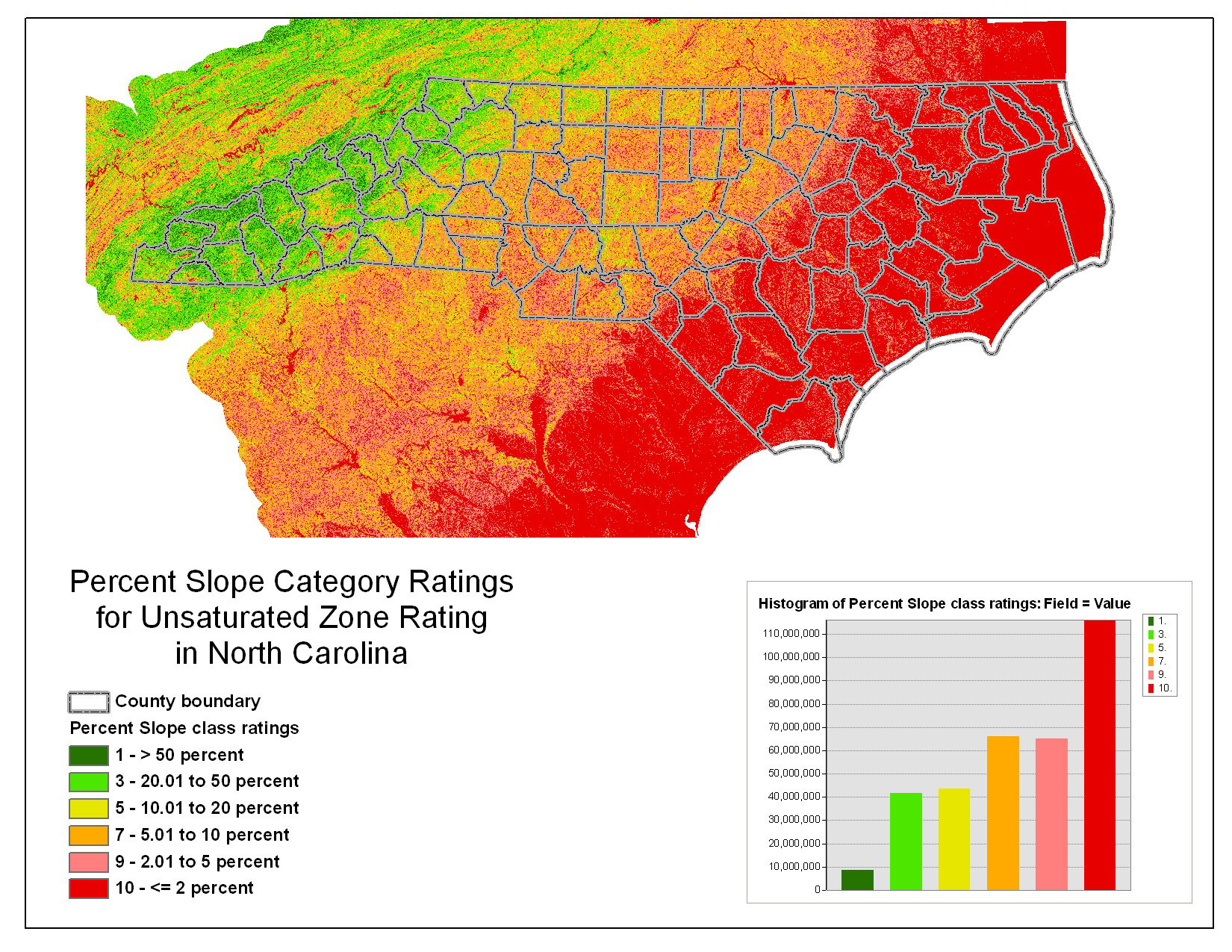
Characterizing the Unsaturated Zone in North Carolina |
Characterizing the Unsaturated Zone in North Carolina |
Characterizing the Unsaturated Zone in North Carolina |
Characterizing the Unsaturated Zone in North Carolina |
| Watershed Characteristics |
|---|
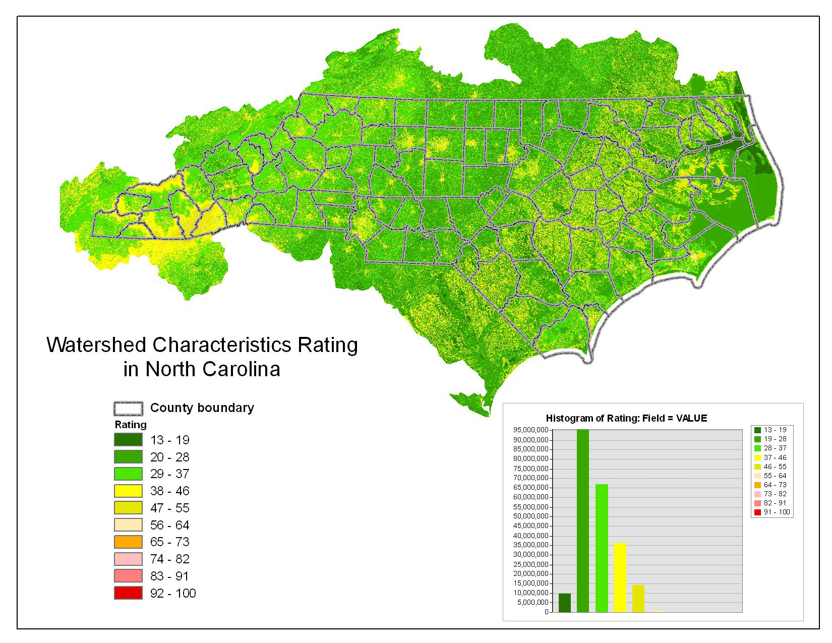
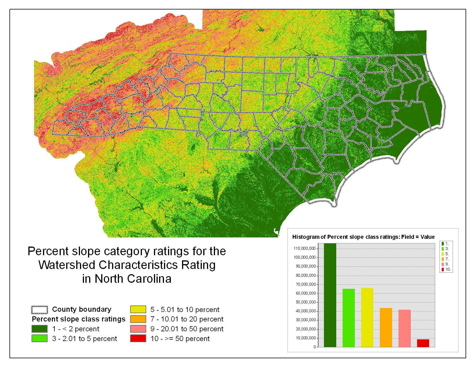
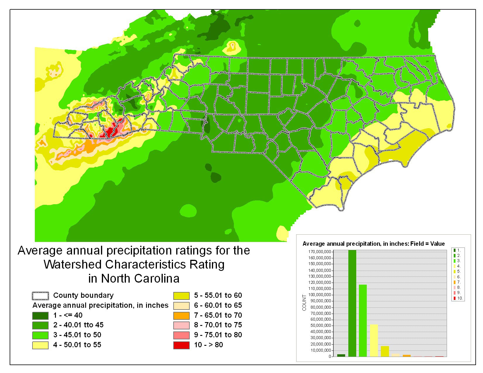
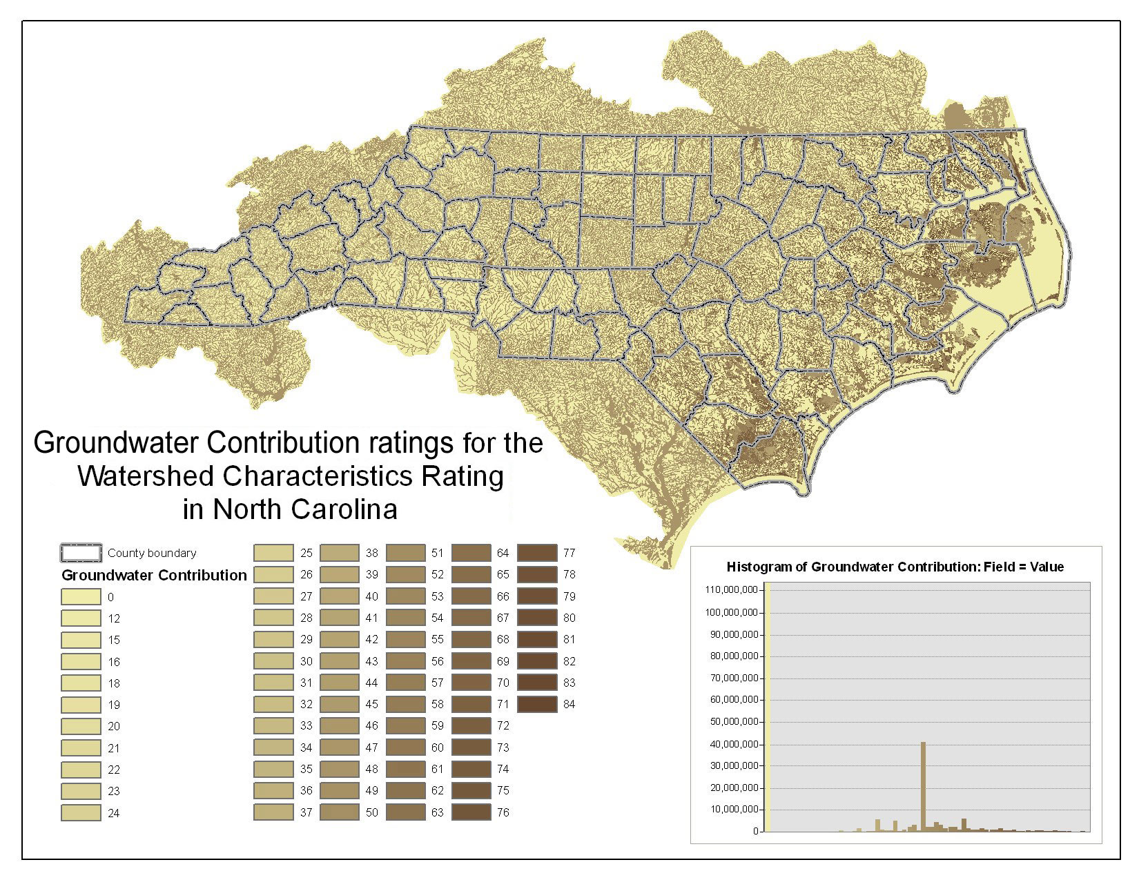
Watershed Characteristics Rating |
Characterizing the Watershed Characteristics of North Carolina |
Characterizing the Watershed Characteristics of North Carolina |
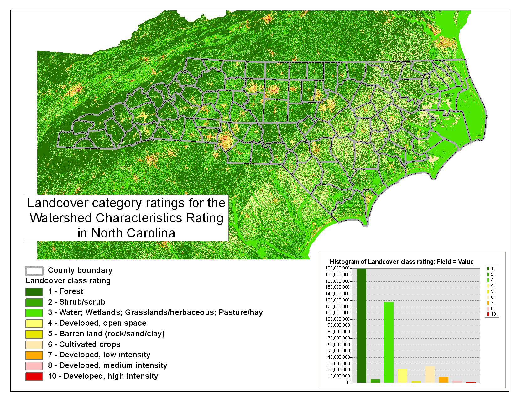
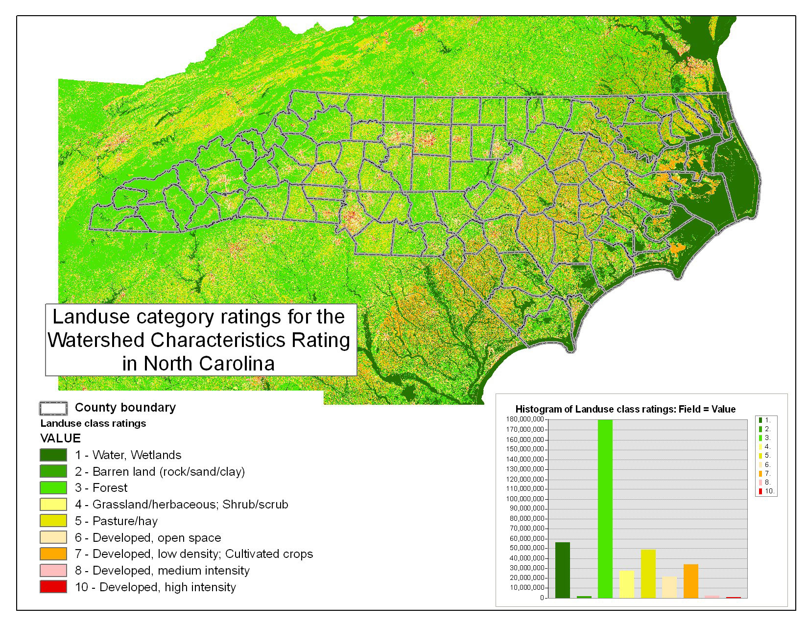
Characterizing the Watershed Characteristics of North Carolina |
Characterizing the Watershed Characteristics of North Carolina |
Characterizing the Watershed Characteristics of North Carolina |
Additional Previously Published Metadata