
The USGS is the lead Federal science agency responsible for addressing water quality, water availability, water conservation, and hydrologic hazards. (National Research Council, 2001a)
The North Carolina District of the Water Resources Discipline, U.S. Geological Survey (USGS), is committed to collecting hydrologic data and conducting hydrologic investigations of the highest quality. North Carolina District staff understand that credible data and useful research lead to better decisions regarding water and environmental resources by managers, planners, regulators, and the public, and ultimately to a higher quality of life for the citizens of North Carolina and the Nation.
 The water-resources data and information needs in North Carolina are great, while the fiscal and staff resources of the North Carolina District are limited. Moreover, District activities must be consistent with and integrated into the hydrologic science agendas established by State and local agencies, the USGS, and the worldwide scientific community. The North Carolina District science plan provides a framework within which decisions can be made to plan for future activities and to appropriately allocate District resources to address the highest priority State and national needs.
"The Cooperative Water Program offers the highest level of scientific knowledge, objectivity, and technical expertise. The Cooperative Water Program is integral to providing long-term data collection and analysis of water quantity, quality, and use on a national basis. Without the Cooperative Water Program, the Nation would not have information vital to the routine management of the Nation's water resources and critical in the management of water-related emergencies." (Blanchard, 1999)
At the recommendation of the National Academy of Sciences in 1878, the United States Geological Survey was formed on March 3, 1879, as "an independent organization" to provide a "thorough knowledge" of the "geological structure, natural resources, and products" of the Nation (U.S. Congress, 1879). The USGS Cooperative Program, which would characterize many of the later water-resources investigations, began in 1884 with an agreement between the USGS and Massachusetts for a jointly funded topographic survey of the State (Rabbit and Rabbit, 1954).
The Cooperative Program has contributed to water resources knowledge for more than 100 years. In North Carolina, the first cooperative streamgage was established on September 17, 1895, at the French Broad River at Asheville by USGS hydrographer Cyrus Babb and North Carolina State Geologist John Holmes. The streamgage at the French Broad River at Asheville has been in continuous operation since that time.
During 2000, cooperative water studies were conducted by USGS personnel in every State, in Puerto Rico, and in several territories. Nationwide, nearly 1,400 cooperators, representing State, county, municipal, and Tribal agencies, as well as interstate compact organizations, conservation districts, water-supply districts, sanitary districts, drainage districts, flood-control districts, and similar organizations, participated in the program. In 2002, the North Carolina District had cooperative agreements with 5 State agencies, 12 cities, 6 counties, 4 regional agencies, and 2 university groups. Through the pooling of support, the USGS is able to conduct studies that lead to an improved understanding of the Nation's water resources to the mutual benefit of all levels of government, and at substantial financial savings to any one agency.
In the Cooperative Program, typically about half of the funds support the collection of hydrologic data; the remaining half support hydrologic investigations and research. In 2000, the Cooperative Program provided funding for the operation of more than 4,200 streamgages—about two-thirds of the total streamgages operated by the USGS. The Program also provided funds for the collection of ground-water-level data at approximately 27,000 wells and water-quality data at about 1,900 surface-water stations and 4,800 ground-water well and spring stations. Since the early 1970's, the number of investigations that emphasize water-quality issues has increased. Some water-quality issues being addressed are aquifer contamination, river quality, stormwater-runoff quality, and the effects of acid rain, mining, and agricultural chemicals and practices on the hydrologic system. (Adapted from The Cooperative Water Program at http://water.usgs.gov/coop/.)
This report presents the science plan of the North Carolina District, along with pertinent supporting information. The plan contains science goals for the priority water-resources issues during 2003–2008 and provides a summary of actions to be taken to achieve these goals. The plan does not include all anticipated District activities, but focuses on selected regionally and nationally important aspects of hydrologic science that are appropriate for the USGS, both in terms of Federal role and scientific capabilities. Finally, the report is not a detailed planning document, but is intended to be a guide for more detailed science planning processes within the District.
 The science goals presented here can be used to evaluate the relevance of individual projects and to plan for future activities, including hiring, infrastructure development, and program development. Successful execution of the North Carolina District science program requires a systems-science approach (broad interdisciplinary and integrated studies), a long-term commitment to high-quality monitoring and data analysis, and effective partnerships.
This science plan can be used by District and regional management to formulate, justify, and support long-term water-resources programs and to maintain institutional resolve to continue sustained support of monitoring and research. The plan can be used to communicate the District science program to elected officials, partners, other agencies, and the research community at large, with goals of enhancing collaborative opportunities, sharing information, and maintaining dialogue within the District and with partners regarding the directions of USGS water-resources activities.
USGS "has demonstrated repeatedly the value to the nation of an independent federal agency whose primary purpose is to provide reliable and unbiased science data, information, and knowledge." (National Research Council, 2001a)
 The USGS is the lead Federal science agency responsible for addressing water quality, water availability, water conservation, and hydrologic hazards (National Research Council, 1997, 1999, 2001a, 2002) and is unique among Federal natural-resource agencies in that it has no regulatory function or advocacy role. The USGS is purely an earth science and information agency, separate from regulatory agencies, with responsibilities to collect, map, develop, archive, and provide continuous, reliable data, information, and cohesive knowledge about the Nation's water, geologic, and biological resources and geospatial data.
 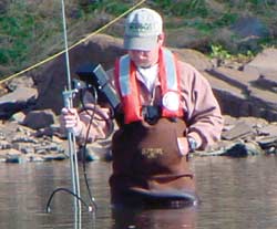 According to the National Research Council (2001a), "the USGS in the twenty-first century will be expected to exercise strong national leadership . . . as the DOI's primary source of science expertise and information and as the principal Federal agency for science information and research related to conservation and management of natural resources and to natural hazard mitigation." The USGS uniquely develops interdisciplinary hydrologic science programs that have regional, national, and global perspectives. The ability of the USGS to integrate geologic, hydrologic, geographic, and biological capabilities provides unparalleled opportunities to translate good science into useful and usable information.
Science planning in the USGS occurs at a variety of levels. The USGS Strategic Plan (U.S. Geological Survey, 2000) identifies two mission goals:
These mission goals support all five of the DOI's strategic goals. The USGS also has identified eight future science directions, which are areas of increasing emphasis for the agency, the Nation, and the world, and for which the discipline mix and capabilities of the USGS create the opportunities for significant successes. The eight future science directions are 
Documents describing science goals and plans for each of these future science directions are undergoing review within the agency.
The Water Resources Discipline (WRD) strategic directions document (U.S. Geological Survey, 1999) identifies nine priority water-resources issues. The document provides plans to address these issues, and discusses strategic efforts for enhancing long-term hydrologic data-collection programs; interpretation and assessment activities; research and development; and investments in new capabilities. Each year, the WRD identifies water-related issues that require USGS involvement at State and local levels through the Cooperative Water Program (see sidebar). Cooperative Water Program priorities for 2002 can be found at http://water.usgs.gov/coop/. These priorities are used to assist Districts in allocating limited Federal funds.
 At the Eastern Region, South, science priorities for USGS water programs include
These science priorities are similar to those identified in the 1999 WRD strategic directions document. Science planning in the North Carolina District builds on plans developed at regional and national levels, with an emphasis on North Carolina issues but also with a supporting role in regional and national issues.
Operating procedures of the North Carolina District science program are given in the report "Quality-Assurance Plan for Water-Resources Activities in North Carolina," which was updated in 2003. The plan[an error occurred while processing this directive], which is available on the District's internal Web site, is a dynamic document that is continually being revised as conditions change or new technology becomes available. The District plans to publish the updated quality-assurance plan in FY04 as an Open-File Report, place it on the public Web page, and distribute it to cooperators and partners. The quality-assurance plan contains chapters on general procedures for investigations, water-quality activities, surface-water activities, ground-water activities, flood response, safety, and chemical hygiene. The District quality-assurance plan is consistent with USGS and WRD policy and technical guidance.
The Quality-Assurance Committee works within the District to ensure the highest quality data-collection, information archival, and interpretive activities. The committee accomplishes this by  (1) conducting periodic reviews of field procedures, office files, and data; (2) actively participating in project and report teams; (3) informing District leadership of issues affecting the technical quality of District products; (4) recommending new policy to improve product quality; and (5) working closely with District staff on all technical issues throughout the life of a project, from proposal preparation to report approval and data archival.
North Carolina District staff throughout the State (fig. 1) maintains contacts with other agencies and scientists in the State by attending meetings, scientific conferences, and distributing publications. Through these contacts, a scientific project begins to develop when a representative of another agency (Federal, State, regional, or local) approaches the USGS about a water-resources issue or problem. Following discussions and an expression of interest by the USGS to address the issue, the agency requests a formal proposal of work from the USGS. The proposal is prepared, reviewed extensively within the District, sent to the Eastern Region, South, for approval, and submitted to the agency requesting the work. Many times, colleagues from the university community or other agencies are involved in project formulation and execution. After negotiations, the scope of work, schedule, and funding are finalized. The USGS can, depending on the availability of Federal funds, provide as much as 50 percent of the cost of projects conducted in cooperation with State, local, and regional agencies.
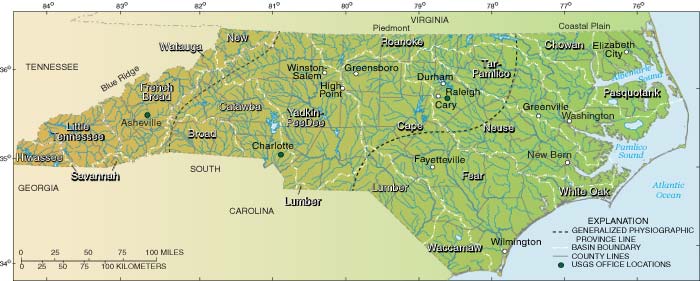
Figure 1. Locations of USGS offices, major river basins, and physiographic provinces in North Carolina.
The quality-assurance plan is the guiding document for USGS projects, most of which involve data collection, followed by data analysis and interpretation and report preparation. Results are published in USGS reports and technical journals and presented at scientific and public meetings. All USGS publications undergo a rigorous review and approval process that includes reviews by supervisors, USGS colleagues inside and outside the District, and discipline specialists, prior to Director's approval, which has been delegated to the Eastern Region, South. All data from all projects (whether interpretive or purely monitoring) are published and archived in the USGS National Water Information System (NWIS) database.
In addition to projects conducted in cooperation with other Federal agencies and with State and local agencies, the North Carolina District conducts investigations as part of national USGS programs, such as NAWQA (National Water-Quality Assessment), NSIP (National Streamflow Information Program), and the Hydrologic Benchmark Program. These USGS programs have distinct national goals. Districts often leverage these national programs to achieve results of interest to local water-resources managers while meeting national objectives. Federal projects follow the same project development as those performed in cooperation with other agencies.
In addition to water-resources programs, the USGS Geology, Biology, and Geography Disciplines also have a presence in North Carolina (fig. 2). Geology Discipline (GD) scientists from the BRASS (Bedrock Regional Aquifer Systematics Study) Earth Surface Processes Team are working with WRD scientists in the North Carolina District and North Carolina Department of Environment and Natural Resources, Division of Water Quality Groundwater Section, scientists on a long-term regional ground-water study in the Piedmont and Blue Ridge Provinces of North Carolina. GD scientists are mapping lithologic contacts, distribution of rock types, and fractures at land surface in two type-areas (areas classified as representative hydrogeologic settings). These surficial geologic data will be compared with subsurface geologic and borehole geophysical data collected from wells drilled as part of this study.
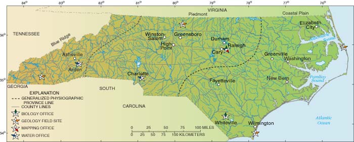
Figure 2. Locations of discipline-based science activities in North Carolina.
The GD Southeastern Coastal Plain project (Earth Surface Processes Team) involves collecting deep stratigraphic cores to improve the geologic model of the Southeastern Coastal Plain region. GD scientists have drilled one corehole in North Carolina at Kure Beach. A well was installed, with WRD, Office of Ground Water support, into an artesian zone of the Black Creek aquifer. Researchers from Duke University also installed a downhole seismometer in the well. A technical steering committee composed of local university researchers, State agencies, and the USGS guides the project.
Scientists at the GD Woods Hole Coastal and Marine Geology Center (Coastal and Marine Geology Team) are working with the North Carolina Geological Survey Coastal Plain Office to map offshore/onshore stratigraphy and paleochannel features of the Outer Banks. GD scientists have conducted high-resolution offshore marine seismic and land ground-penetrating radar focused on the delineation of buried paleochannels in the Roanoke River. University researchers also are involved in data collection and interpretation. District WRD staff recently (February 2002) participated in core drilling efforts and installed three shallow wells intended for use as part of a potential new saltwater intrusion monitoring network.
The Biology Discipline (BD) has scientists located at North Carolina State University in the Cooperative Fish and Wildlife Unit (Coop Unit) and collocated with the U.S. Department of Agriculture Border Belt Tobacco Research Station in Whiteville, N.C. The Coop Unit is sponsored jointly by the USGS, the North Carolina Wildlife Resources Commission, North Carolina State University, and the Wildlife Management Institute. The Coop Unit was established to facilitate cooperation among the Federal government, colleges and universities, the States, and private organizations for cooperative programs of research and education relating to fish and wildlife. Most of the Coop Unit's research projects are field oriented and conducted by graduate students in close cooperation with university and agency biologists.  Some of the current research projects (Biological Resources Division, 2002) being conducted at the Coop Unit include
BD activities at the Whiteville location are related primarily to development of an invasive-species database. BD staff from other States also conduct studies in North Carolina, most of which occur on the Federal lands of western North Carolina.
In November 2001, the USGS Geography Discipline established the Eastern Region Geography Liaison Office in Raleigh to enhance and maintain partnerships with WRD. In addition, this office is intended to establish relations with other Federal, State, and local government agencies in North Carolina to enhance geospatial data collection and applications in the State.
Currently, the USGS has an agreement with the North Carolina Geological Survey to inspect and produce quadrangle topographic map revisions. An agreement also exists with the North Carolina Center for Geographic Information and Analysis (CGIA) to produce color infrared digital orthophotography quadrangles (DOQ's) for western North Carolina, as well as a high- resolution national hydrography dataset (NHD). All of these Geography Discipline agreements effectively provide base geospatial data, which can be used for a variety of WRD activities. A Geography Discipline project, called the 120-Cities for Domestic Preparedness, is being conducted to produce high-resolution color orthophotography over designated combined-city areas throughout the United States, including the Raleigh/Durham area, the Winston-Salem/Greensboro/High Point area, and Charlotte. The data produced for these three areas will be in the public domain and will provide excellent high-resolution base imagery that can be used for a variety of purposes and studies.
 Basic information about the characteristics of North Carolina provides the context for water-resources science planning in the North Carolina District. Information presented here includes geography, climate, population, economy, geology, and water resources, as well as an overview of the Federal, State, and local water-resources management programs in North Carolina.
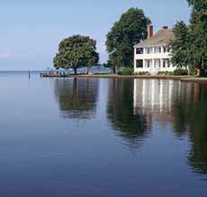
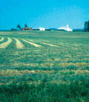
North Carolina's mild temperatures and abundant moisture contributed to a historically productive agricultural economy and support the State's rapid growth as a business, high technology, and manufacturing center. Clean and abundant water supplies are vital to the State's economic health, the physical health of its residents, and the health of aquatic life that inhabit the State's streams, rivers, lakes, and estuaries.
North Carolina is located in the Coastal Plain, Piedmont, and Blue Ridge physiographic provinces (fig. 1) and encompasses 52,669 square miles. About 7.25 percent of the State's total area is inland water.
Forests occupy about 51 percent of the State, with 24 percent of the land area categorized as cropland or pastureland. Developed land area increased from about 7.7 to 10.5 percent between 1982 and 1999; cropland and forested areas each decreased about 2 percent during this time (North Carolina Department of Environment and Natural Resources, 2001).
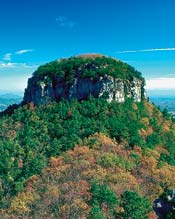
Land-surface elevation ranges from sea level in the east to 6,684 feet in the west at Mount Mitchell, the highest peak east of the Mississippi River. The Eastern Continental Divide runs through the Blue Ridge Province, with rivers on the west slope draining to the Ohio River and, ultimately, the Gulf of Mexico, and rivers on the east slope draining directly to the Atlantic Ocean through North Carolina, South Carolina, and Georgia.
North Carolina has more than 1.2 million acres of National Forests (fig. 3; U.S. Forest Service, 2001). The Pisgah and Nantahala National Forests, in western North Carolina, compose about 1 million acres combined. The remainder of the forest acreage is in the Uwharrie National Forest in the Piedmont and the Croatan National Forest in the Coastal Plain. The State has 10 National Wildlife Refuges (NWR), nine of which are in the Coastal Plain (fig. 3). These refuges encompass more than 391,000 acres, ranging from 3,213 acres at the Currituck NWR to 152,195 acres at Alligator NWR (fig. 3; U.S. Fish and Wildlife Service, 2002). The two primary national parks in North Carolina are the Great Smoky Mountains National Park and the Blue Ridge Parkway. The Great Smoky Mountains National Park is an International Biosphere Reserve and a World Heritage Site and has more than 9 million visitors annually.
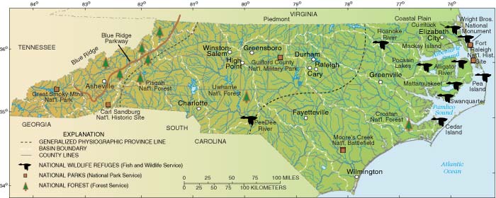
Figure 3. Locations of Federal lands, national parks and monuments, wildlife refuges, national forests, and physiographic provinces in North Carolina.
North Carolina experiences all types of weather from heavy snows, coastal storms (northeasters), freezing rain and sleet, drought, flooding, hail, tornadoes, and tropical cyclones (Boyles, 2000).
Summer generally is the wettest season, with precipitation typically produced by thunderstorms (Boyles, 2000). Tropical cyclones, which can result in locally heavy rainfall, occur mostly in August and September. Winter precipitation typically is produced by the passage of frontal systems from west to east, although coastal lows can develop rapidly and produce large rainfall and snowfall amounts across the Piedmont and Coastal Plain. The Macon County area has the highest annual average precipitation in the eastern United States (fig. 4) yet less than 60 miles away, near Asheville, the annual average rainfall is the lowest in the State (about 38 inches). Although high snowfall amounts can occur throughout the State, snowmelt runoff is not a particularly important part of the State's hydrology.
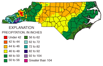
Figure 4. Average annual precipitation in North Carolina, 1961–90 (North Carolina State Climate Office, 2002).
Precipitation amounts have increased across much of the State (Boyles, 2000). During 1949–98, annual average precipitation increased approximately 8 inches at Wilmington and approximately 3 inches each at Charlotte, Greensboro, and Raleigh. 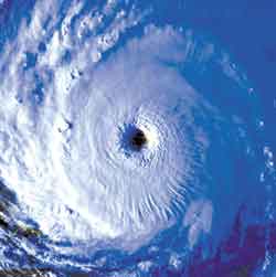 Asheville had no apparent change in annual precipitation amounts during the period. Most of the precipitation increases were associated with fall and winter precipitation. Trends in seasonal maximum and minimum temperatures across the State (Boyles, 2000) indicate increased minimum temperatures and decreased or unchanged maximum temperatures.
North Carolina is particularly susceptible to hurricanes and tropical storms, which have caused flooding in all parts of the State (Zembruzski and others, 1991). About 3 percent of all Atlantic tropical cyclones make landfall in North Carolina, and about 1 in 5 pass within 300 miles of the State (Bales and others, 2000). Three of the five most costly hurricanes have affected North Carolina. From 1998 to 2002, the State has experienced landfall of two Category-3 and two Category-2 hurricanes.
According to the 2000 Census, North Carolina is the eleventh most populous State, with a population of about 8.05 million. The State's population increased more than 21 percent during the 1990's, compared to the Nation's 13-percent increase.  North Carolina was the seventh fastest growing State in the Nation during the 1990's, partly because of its low cost of living and relatively low unemployment rate.
Population growth is occurring mostly in selected coastal and mountain counties and in the Piedmont metropolitan area. About 56 percent of the State's population is concentrated in Piedmont urban areas. The "Piedmont Urban Crescent" stretches from Charlotte through the Triad and eastward to Raleigh and is where much of the manufacturing activities occur. The population of Wake County, which is in the Piedmont Urban Crescent, increased by 47 percent during the 1990's.
The rapid population growth in selected coastal and mountain counties is attributed primarily to the influx of retirees to these areas. Populations in the coastal counties of Brunswick, Pender, Currituck, Dare, and New Hanover increased by more than 23 percent during 1990–2000. The mountain counties of Macon, Clay, Henderson, and Polk in the southwestern part of the State had the highest population growths in that province. Several counties, primarily in the northeastern part of the State, had decreases in population or grew at very slow rates during the 1990's (U.S. Census Bureau, 2000).
 Agriculture, North Carolina's largest industry, accounts for nearly one quarter of the State's income (about $46 billion per year) and employs 22 percent of the work force. The State has about 57,000 individual farms, and one-third of the State's 31 million acres are used for agriculture. North Carolina produces more tobacco and sweet potatoes than any other State and ranks second in the production of hogs, turkeys, Christmas trees, and trout (North Carolina Department of Agriculture and Consumer Services, 2002).
North Carolina agriculture has experienced two important trends. First, animal agriculture has replaced row crops as the leading source of income. The number of hogs, turkeys, and chickens has increased, but the number of dairy cattle and sheep has decreased. Second, agricultural production has shifted from the more erodible and less productive hilly land in the west to the flatter, less erodible, and more productive land in the east. During the 1970's and 1980's, swampland and wetlands in the State were converted to agriculture, although this trend has subsided because of changing economic and regulatory conditions.
Tourism is the second largest industry in the State, accounting for about 43 million visits in 2000 and about $12 billion in tourist-related revenue. Major tourist attractions include the more than 500 golf courses in the State, national parks and forests, casinos on Tribal lands, horse racing, and the coastal beaches and sounds. Manufacturing is a major part of the North Carolina economy. About 20 percent of the State's non-farm workers are employed in manufacturing.
 North Carolina's physiographic provinces represent distinct geologic settings (fig. 5). The Piedmont and Blue Ridge Provinces are composed of complex metamorphic, igneous and metasedimentary, and sedimentary rocks that have been exposed to sometimes intense heat and pressure related to mountain building and associated folding and faulting. As a result, these rocks have little or no primary porosity, and most ground water occurs in secondary fracture networks and the overlying weathered regolith.
By contrast, the Coastal Plain is composed of layers of sediments and sedimentary rock deposited over millions of years as the Atlantic Ocean transgressed and regressed to the east, and as the Piedmont and Mountains were eroded from the west. These layers of porous sediments and rock form a series of productive regional aquifers that store vast quantities of ground water (fig. 6).
The soils of North Carolina are a product of their geologic, geomorphic, and climatic environment, as well as site-specific characteristics such as moisture and vegetation (Daniels and others, 1984). The Coastal Plain is composed of sandy to clayey unconsolidated sediments, with a large percentage of hydric soils. The Piedmont includes a large number of soil systems because of the complex geology of the underlying metamorphic and igneous rocks. Soils in the Blue Ridge are shallower than those in the Piedmont and Coastal Plain, resulting in a lower water-holding capacity.
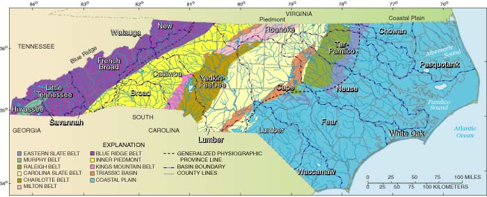
Figure 5. Generalized geologic map of North Carolina.
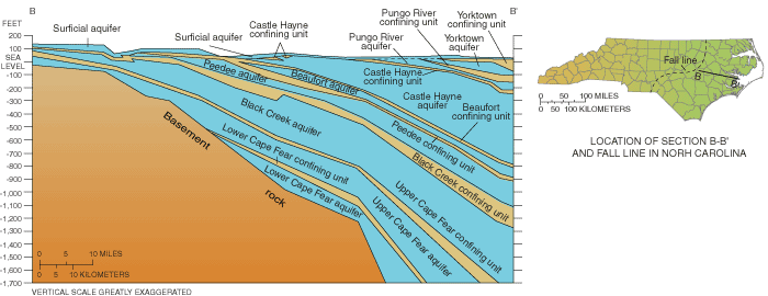
Figure 6. Aquifers of eastern North Carolina.
North Carolina has more than 37,000 miles of freshwater streams, more than 1,500 lakes and reservoirs of 10 acres or larger, 4,000 miles of estuarine shoreline, more than 3,200 square miles of estuarine waters, and 320 miles of ocean beach. 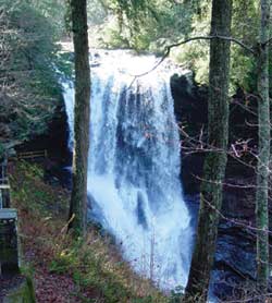 The surface- and ground-water resources of North Carolina reflect the range in topographic and geologic settings across the State, from fast-moving mountain streams in the Blue Ridge, to reservoirs and sediment-laden rivers in the Piedmont, and blackwater coastal rivers and broad expanses of estuarine waters in the Coastal Plain.
For management purposes, North Carolina has 17 river basins (fig. 1; State agencies combine the Lumber and Waccamaw River Basins into the Lumber Basin). Most of the rivers that flow through North Carolina have their origins in the State. The Tar, Neuse, and Cape Fear River Basins are located entirely within the State. Only the Roanoke River and the Chowan River have their headwaters outside of the State in Virginia. Some streams in the Pasquotank River Basin also have their head-waters in Virginia, but the topographic divides for this basin are difficult to determine because of canals that cross natural drainage boundaries. The Yadkin, Lumber, and Waccamaw Rivers all combine and drain to the same ocean outlet in South Carolina. Likewise, the Broad and Catawba Rivers in North Carolina combine to form the Santee River in South Carolina. The Hiwassee, Little Tennessee, French Broad, and Watauga Rivers are part of the Tennessee River Basin. The New River (in the western part of the State) is unique in the eastern United States in that it flows northward over most of its course, eventually emptying into the Ohio River.
Rivers in the western and central part of the State are regulated to varying degrees. Most large reservoirs in the Blue Ridge are operated by the Tennessee Valley Authority and private power companies. The Catawba River is regulated along its entire length by a series of seven dams operated by Duke Energy. Two power companies and the U.S. Army Corps of Engineers (ACE) regulate flows in the Yadkin River Basin. The ACE also operates one reservoir each in headwaters of the Neuse River Basin and the Cape Fear River Basin. Flows in the Roanoke River are highly regulated by an ACE dam in southern Virginia and two downstream power company dams. 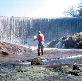 Although the Roanoke River flows more than 135 miles from the downstream-most dam to Albemarle Sound, the small amount of additional contributing drainage area means that the upstream dams have a controlling influence on flow all along the river. No major reservoirs are located in the Coastal Plain because of the lack of topographic relief, but there are numerous natural lakes in the region.
The Albemarle-Pamlico estuarine system is the Nation's largest lagoonal estuary, and the second largest estuarine complex in the conterminous United States. Pamlico Sound is a major fish and shellfish nursery for the entire Atlantic Coast, supporting more than 90 percent of North Carolina's commercial catches and 60 percent of its recreational finfish and shellfish catches (Copeland and Gray, 1991). Inshore nursery areas provide habitat for a large variety of estuarine and anadromous fish. Submerged aquatic vegetation, which is disappearing from many locations, plays a major role in providing habitat for juvenile fish.
Excessive sediment loads, more than any other pollutant, is causing stream segments in North Carolina to fail to meet their designated use (or are 303(d) listed), resulting in poor macrobenthic community ratings (North Carolina Department of Environment and Natural Resources, 2000). Microbiological pathogens, as indicated by excessive fecal coliform counts, also are a cause for use impairment in many North Carolina surface waters. Excessive nutrient loading to the State's surface waters is a growing concern, particularly with regard to protection of water-supply reservoirs and estuaries. Nuisance algal blooms have occurred in many of the State's water-supply reservoirs. Hypoxic conditions regularly occur in the Pamlico River, Neuse River, and Cape Fear River estuaries and occasionally are observed elsewhere in the State's inshore coastal waters. Fish-consumption advisories exist throughout the State for a variety of contaminants, with statewide advisories in effect for mercury (North Carolina Department of Environment and Natural Resources, 2002).
Ground-water resources supply about half of North Carolina's population with drinking water (Walters, 1997). The principal aquifers in North Carolina are the surficial, Yorktown, Castle Hayne, and Cretaceous aquifers in the Coastal Plain (fig. 6) and the crystalline rock aquifer in the Piedmont and Blue Ridge Provinces.  Population growth in the Coastal Plain has resulted in increased pumping from the aquifers, producing ground-water-level declines of 100 feet or more. Increased pumping can cause rapid lateral migration of saltwater along the coastline and vertical upconing of brackish water from underlying aquifers. Ground-water-level declines also contribute to land-surface subsidence, interaquifer leakage, and increased economic costs. The widespread application of pesticides and fertilizers (chemical and organic) to agricultural lands in the Coastal Plain has led to concerns about ground-water quality in the region (Spruill and others, 1998). Less is known about the fractured crystalline rock aquifer of the Piedmont and Mountains. Generalized information on ground-water quality, ground-water flow and contaminant transport, and contributions to streamflow is lacking for this region.
Total water withdrawals in North Carolina in 1995 averaged 9,286 million gallons per day; excluding withdrawals for thermoelectric uses, total withdrawals averaged 1,869 million gallons per day (Walters, 1997). Surface water provided 82 percent of public supplies for domestic, industrial, and commercial users. In 1995, 66 percent of the State's population was served by public water supplies. Ground-water withdrawals accounted for about 17 percent of the public supplies. About 167,000 acres of cropland, nurseries, and golf courses were irrigated in 1995, a relatively high-rainfall year. Golf courses accounted for about 60 percent of the irrigation water use. At least 110 water systems rely on interbasin transfer, which is closely regulated by State agencies (North Carolina Department of Environment and Natural Resources, 2001). Several large cities (for example, Charlotte and Cary) withdraw water from one basin and discharge wastewater to a different river basin. Despite the presence of several large reservoirs in the area, cities in the Research Triangle area are considering withdrawals from the Roanoke River Basin to meet future water demands.
The North Carolina Department of Environment and Natural Resources (DENR) is the lead State agency for the protection of North Carolina's natural resources. Among the eight DENR divisions responsible for environmental protection are the Divisions of Water Quality (DWQ), Coastal Management, Land Resources, and Environmental Health. The DWQ issues permits, monitors permit compliance, evaluates water quality, and enforces water-quality regulations.  The Wetlands Restoration Program also is housed within DWQ. The Division of Coastal Management regulates growth and development in the State's 20 coastal counties. The Division of Land Resources enforces the State's sediment and erosion-control regulations and has jurisdiction over small dams. The Division of Environmental Health enforces North Carolina's public water-supply rules, provides technical assistance to local water suppliers, permits on-site wastewater-disposal systems, and investigates hazardous-substance spills that may affect public water supplies.
Among the eight additional DENR divisions that are responsible for the protection and preservation of the State's natural resources are the Divisions of Water Resources (DWR), Soil and Water Conservation, and Marine Fisheries; the Wildlife Resources Commission is an independent agency that works within the framework of DENR. The DWR administers programs for river-basin management, rivers assessment, water-supply planning assistance, water conservation, and water-resources development. The Division of Soil and Water Conservation conducts programs in nonpoint-source pollution management and implementation of agricultural best-management practices. The North Carolina Division of Marine Fisheries is responsible for fisheries management in the State's estuarine and coastal waters, while the North Carolina Wildlife Resources Commission is responsible for fisheries management in the State's freshwaters and for wildlife management throughout the State.
Other State agencies involved in water-resources activities include the Division of Emergency Management (Floodplain Mapping Program and Flood Insurance Program); CGIA (clearinghouse for geographic information in North Carolina); and the Department of Transportation (bridge construction and wetlands mitigation). North Carolina was the first State designated by the Federal Emergency Management Agency (FEMA) as a Cooperating Technical Partner, whereby the State is responsible for development of Flood Insurance Rate Maps (FIRMs). North Carolina has embarked on a program to update FIRMs for the entire State and make them available on the Internet by 2008. The Department of Agriculture manages the State's aquaculture program and regulates pesticide use.
In 1972, 18 Councils of Government (COGs) were established as voluntary organizations of regional, county, and municipal governments to provide services more readily handled on a regional basis rather than by individual local governments. Typical services include programs for the aging, land-use planning, economic development, and environmental protection. Many of the COGs actively participate in water-resources planning for their respective regions.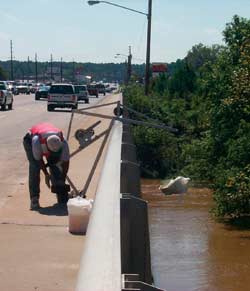
North Carolina city and county governments also actively participate in water-resources planning. Activities include water-supply watershed protection and monitoring, reservoir construction and management, National Pollutant Discharge Elimination System (NPDES) stormwater-permit compliance and monitoring, wastewater-discharge compliance monitoring, and stream restoration. Charlotte and Mecklenburg County operate a flood-warning system, developed in cooperation with the USGS.
North Carolina has numerous river basin associations. Some of the associations are primarily citizens' groups, whereas others are made up of municipal, industrial, and agricultural interests. Several of these associations have river keepers, and many sponsor research and monitoring. For example, the Cape Fear River Assembly receives appropriations from the State General Assembly and, in the past, has sponsored investigations performed primarily by university researchers. The Lower Neuse River Basin Association, which consists primarily of permitted point-source dischargers, funds monitoring in the basin by private consulting firms to meet State permit requirements. The DWQ Albemarle-Pamlico Estuary Program coordinates a large citizen monitoring program in the Albemarle-Pamlico Basin.
In addition to the USGS, other Federal agencies involved in water-resources programs in North Carolina include the U.S. Fish and Wildlife Service; the National Park Service; U.S. Forest Service, which operates two watershed laboratories in the State; and the Natural Resources Conservation Service. The ACE operates several reservoir projects in the State, including Falls Lake, Jordan Lake, Kerr Lake (located partially in North Carolina and partially in Virginia), and Kerr Scott Lake. The ACE is responsible for the Oregon Inlet jetty project and the Wilmington Harbor deepening project, both of which are controversial. The harbor deepening project is underway, but the jetty project has yet to be initiated. The ACE also is involved in a number of beach-nourishment projects along North Carolina's coast. The Gaston and Roanoke Rapids hydropower projects are nearing completion of a lengthy Federal Energy Regulatory Commission relicensing process. Similar processes are beginning on the Catawba River and the Yadkin River.
Water is a key determinant of population growth and distribution, economic development, social and political organization, and the quality of life. . . . Because water resource issues in the United States and elsewhere are unlikely to diminish in upcoming decades, it appears probable that USGS information on streamflows and water use, regional water resource studies, and hydrologic research will be more important in the future than in the past. (National Research Council, 2001a)
Experience has taught USGS scientists and managers that the agency's viability and prosperity depend on an ability to demonstrate the relevance and significance of USGS science to society. As former director Gordon Eaton (2000) said, (which was later reiterated by the National Research Council, 2001a), "It is not enough now for talented scientists to do outstanding work. They must explain and define science's societal payoffs if they are to continue to be funded."
Society—the public, planners, engineers, water-resources managers, policymakers, those involved in hazard mitigation, and others—needs hydrologic science information for at least three reasons.
 Society needs to have immediate and reliable information on water-resources conditions in order to respond to emergencies, control flows, take remedial actions, protect human health, and use the resource efficiently and wisely. Society also needs to have reliable, predictive information in order to know what conditions will be in the future as a result of human actions and climatic fluctuations so plans for these conditions and remediation activities can be implemented. Will flooding be worse if a parcel of land is developed in a certain way? Will droughts become more frequent if global warming continues at the present rate? Will aquatic habitat be restored if the hydrologic regime is modified? Will there be sufficient ground-water supplies of acceptable quality if pumping rates increase? Will water quality improve if certain land-management practices are followed or if a total maximum daily load (TMDL) is implemented?
Finally, society needs to have reliable information on how water-resources systems change through time and the reasons for these changes in order to better use, manage, and protect the resource. Is flooding becoming worse? If so, why? Is water quality improving as a result of improved wastewater treatment? Are TMDL's resulting in improved water quality? Are minimum streamflows decreasing as a result of urbanization or climate change?
Water-resources issues that will be the focus of science activities in the North Carolina District during 2003-2008 are described here. A science goal—in some cases a very specific goal, and in other cases a general goal—is given, along with some key actions needed to achieve the goal. A plan for information transfer, a key part of North Carolina District activities, is followed by a discussion of partners and customers, and workforce issues related to implementation of the plan. Additional planning and interaction with partners will be required to translate the goals in this document into more specific project-level activities.
Although presented separately, the issues and activities in this section are linked; those related to one issue will, in all likelihood, be related to another issue. For example, hydrologic and geospatial data are required for all science activities of the District. Estuarine and coastal processes are affected by agricultural activities; concern about Coastal Plain ground-water resources is directly related to population growth in the region.
There is a strong and continuing need for reliable and continuous measurements of river conditions for both operational and scientific purposes. Operationally, data collection and distribution in near real time are needed for improved warning, mitigation, forecasting, and water-resources operations (National Research Council, 2001b). An adequate water supply, including adequate quality, in parts of North Carolina requires timely and spatially distributed data on the condition of ground- and surface-water resources. "In planning for the management of scarcity, good hydrologic (including water-quality) data will be absolutely essential" (National Research Council, 2001b).
Hydrologic data are needed to provide the basis for routine management, hazard mitigation, and enhanced resource planning. Data are needed to provide information about fluxes, storage, and transformation of water, solutes, and sediments as water moves through the various phases of the water cycle. Data are needed to monitor change in the quantity and quality of water and in ecosystem condition. Data are needed to test hypotheses and models, and to formulate new hypotheses.  Much of the historical water-resources data have been collected to answer operational questions rather than scientific questions, so future science data needs will not be fully satisfied by existing data networks (National Research Council, 1991).
Spatial data are an important component of all the science activities described in this report, as are water-resources data. Water-resources information must be collected and synthesized at a range of spatial and temporal scales. New geospatial information as well as tools for integrating hydrologic and geospatial data offer the prospect of providing hydrologic data in an increasingly meaningful format, and for gaining new, quantitative insights into hydrologic processes. Hydrologic data presented in a geospatial context also facilitate the integration of water-resources activities with other disciplines, as well as interagency data sharing.
The National Map program of the USGS (http://nationalmap.usgs.gov/) is focused on meeting the Nation's needs for current base geographic data and maps. The National Map will provide data and operational capabilities that include high-resolution digital orthorectified imagery; high-resolution surface-elevation data; vector feature data for hydrography, transportation, structures, government unit boundaries, and publicly owned land boundaries; geographic names for physical and cultural features; and land-cover data.
An example of data collected for operational and scientific purposes is a new interagency, interdisciplinary program focused on ground-water quality monitoring and characterization of the ground-water flow system in the Piedmont and Blue Ridge physiographic provinces. The cooperator, NC DENR DWQ, needs this information to protect the complex fractured-bedrock aquifer from which a large percentage of the population in this region obtain their drinking water. Techniques developed by the USGS Toxics Program at Mirror Lake, New Hampshire, are being used in this study, and the USGS GD BRASS project is providing updated, local geologic field mapping. The coordination of State and Federal resources will result in data and understanding that could not be achieved by one agency alone.
Collect, interpret, and distribute hydrologic data and hydrologically relevant geospatial data with sufficient spatial and temporal resolution to support the water-resources needs of all users.
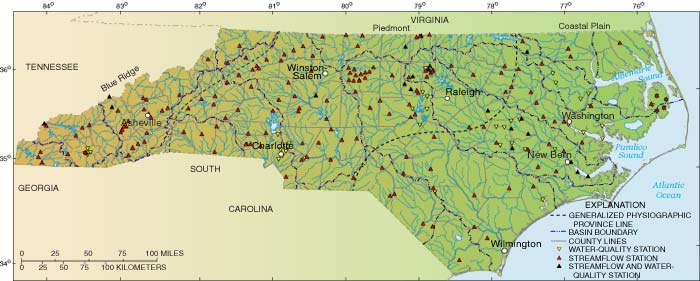
Figure 7. Locations of water-quality, streamflow, and streamflow/water-quality stations, major river basins, and physiographic provinces in North
Carolina.
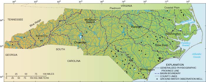
Figure 8. Locations of ground-water observation wells, major river basins, and physiographic provinces in North Carolina.
The USGS provides data and information for monitoring and mitigating a wide range of natural hazards, including earthquakes, floods, hurricanes, landslides, coastal erosion, wildlife diseases, and wildland fires. The USGS documents hazard events and develops tools to assist in disaster response and in mitigation planning. The USGS develops improved monitoring techniques and faster communication links to decision makers and the general public so that they get the information they need during these often fast-breaking events.  This work involves extensive collaboration with other Federal agencies and with State and local officials, among others, to reduce loss of life and property damage.
Although three-fourths of all diasters declared by the President are water-related (National Research Council, 1999), knowledge of flood generation, for both flash floods and large regional floods, is very limited (Klemes, 1988; Smith and others, 1996; Burgess, 1998). Hydrologic persistence, varieties of flood-generating meteorological events, effects of human activities on floods (for example, Criss and Shock, 2001), and the likelihood of the nonstationarity of records all indicate a need for a better understanding of floods (Klemes, 1988; Baker, 1993).
Droughts affect more people than any other natural hazard (Natural Hazards Observer, 2001). Although droughts may cause greater economic losses than floods, they are much less dramatic and occur over longer periods of time than floods. Critical needs arise during drought years as reservoirs and shallow ground-water levels may fall dramatically, resulting in emergency water-use restrictions. The western North Carolina Piedmont remains under 5+-year drought conditions, as shallow ground-water levels continue to reach 20-year period-of-record lows. Many shallow wells have gone dry in this area of the State, and intensive drilling of wells in deeper bedrock and associated pumping interference has resulted in dewatering of aquifer fractures in some local areas.
An understanding of regional ground-water conditions becomes particularly important during droughts because of ground-water and surface-water interactions and ground-water contributions to baseflow. Droughts reduce delivery of nutrients to aquatic ecosystems and reduce available aquatic habitat. Land-use activities may influence the occurrence of droughts, or certainly the magnitude and frequency of low flows. Improved understanding of the effects of droughts on the landscape, and improved drought-characterization methods (for example, Kroll and Vogel, 2002) could substantially improve streamflow forecasting and water management (Burgess, 1998).
Just since 1996, North Carolina has experienced 100-year or greater floods from Charlotte (1997) to the Research Triangle area (1996) and to eastern North Carolina (1999). Following Hurricane Floyd in 1999, all of the river basins in eastern North Carolina, except the Lumber River Basin, experienced 500-year or greater floods. Despite these floods, parts of the State have been in a prolonged moderate drought that began in about 1995.
Provide information and real-time data needed by resource- and emergency-management officials to respond to and mitigate the effects of floods and droughts in North Carolina.
North Carolina is experiencing dramatic population growth, and the State is changing from a predominantly rural to a predominantly urban landscape. Much of this growth is occurring in the headwaters of basins, such as Greensboro and the Research Triangle Park area, where surface-water supplies are somewhat limited. Moreover, ground-water supplies and community wells generally cannot meet the demands of large populations in the Piedmont, where most of the large urban centers are located and where crystalline-bedrock aquifers do not yield large amounts of water.  Growth in the coastal counties is stressing limited ground-water supplies. Because projections of water-supply demand often are made 20 to 50 years into the future, unanticipated growth can lead to water shortages, even in areas where supplies were once thought to be abundant.
Population growth also is often accompanied by degradation of aquatic resources. As noted by the National Research Council (2001c), "Threats to biological diversity . . . are generally unintended consequences of the development of human societies, growth in human population, and efforts to improve standards of living. Practical efforts to protect species and ecosystems must reconcile ecological objectives with human needs." Protection of the State's water and living resources in the face of the changing landscape is one of the most difficult challenges facing North Carolina.
Increases in impervious area from the expansion of urban centers typically increases the rate of surface runoff and reduces recharge to the ground-water system and thereby reduces baseflow to streams. Residential areas can contribute more nitrogen and pesticides to stormwater than other land uses (Brush and others, 1994; Frick and others, 1998; Bales and others, 1999). Sediment runoff from construction sites in urban areas reduces plant growth and affects water quality in biological habitats, both on land and in streams. Changes in sediment loads and streamflow variability resulting from urbanization can have disastrous effects on stream-channel habitat.
The cumulative impacts of landscape change in a watershed are difficult to quantify, but must be considered if living resources are to be protected. 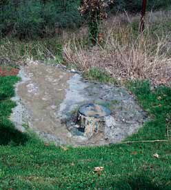 Predictive tools are needed to guide development, to mitigate effects of landscape change, and to anticipate cumulative and secondary impacts before they occur.
A relatively small amount of water is needed by humans to survive physiologically. Much larger amounts, however, are needed per capita to survive as a community and to support aquatic ecosystems (Black, 1995), although the amount and timing of water to support aquatic systems is still poorly understood (National Research Council, 1991, 2001c). More than half of the State's population now lives in urban environments, but an understanding of the water cycle in urban areas and the effects of urbanization on the water cycle is poor compared to what is known about forested and agricultural basins (National Research Council, 1997).
The USGS has conducted a water-use program for many years (for example, Walters, 1997; Solley and others, 1998). The program has provided some of the only nationally consistent information on water use, but funding for the program is limited and information on factors affecting water use is lacking. Managing water resources to adequately meet a variety of needs requires good data and information on water use and on the conditions affecting water use. An understanding of water use is particularly important when the concept of water use is expanded beyond the traditional areas of human, agricultural, and industrial use to include such uses as maintenance of aquatic habitat and assimilation of contaminants (National Research Council, 2002).
Provide reliable information on water use, including instream needs, and conduct studies in collaboration with others to understand the effects of urbanization on ground- and surface-water quantity and quality.
Ground-water levels have been declining in the Cretaceous aquifers (Black Creek and upper Cape Fear) of the central Coastal Plain (CCP) for at least several decades. Recently, ground-water declines have occurred in the southern Coastal Plain. These declines are related to population increases and agricultural activities—both of which are North Carolina District Science Plan issues.
In August 2002, new State legislation will require a reduction in ground-water pumping in specified areas of the 15 CCP counties. 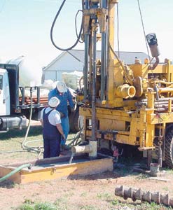 All wells pumping 100,000 gallons or more per day must be registered with the State Division of Water Resources (DWR). Currently, permitting is required only in Capacity Use Area 1 (CUA1), located in the eastern Coastal Plain. Since 1967, CUA1, in Beaufort county near Aurora, has had restricted pumping related to dewatering of the Castle Hayne aquifer near a phosphate mine. In addition, any surface-water or ground-water withdrawals of 10,000 gallons or more per day must be registered with the State.
Consideration of alternative resources, including other unregulated aquifers and surface-water resources, must be undertaken soon to address current and future water-supply demands. Ground-water-flow models for the Coastal Plain, developed as a part of the USGS Regional Aquifer System Analysis (RASA) Study, have not been updated since their development in the 1980's (Winner and Coble, 1996; Giese and others, 1997). An updated model could be used to evaluate the effects of reduced pumping and the resulting effects on alternative water-supply sources. Updated information on water-use and recent ground-water-level data would be needed for model calibration and testing.
Declining ground-water levels in the Coastal Plain also may affect baseflow to streams. The role of ground water in streamflow generation is poorly understood. The possible reduction in streamflow from overpumping of Coastal Plain aquifers has not been evaluated, but baseflow reduction could have serious effects on instream biological habitat and riparian wetlands.
Provide information and data needed by resource-management officials and scientists to assess the effects of overpumping of the Cretaceous aquifers on the hydrologic and ecosystems in the Coastal Plain of North Carolina and to identify acceptable alternative supplies.
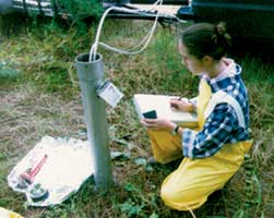
The USGS works with researchers from Federal and State agencies and universities to provide data and analyses on the processes that affect water resources impacted by agricultural practices in the State. The USGS collects data for ground- and surface-water chemical and biological quality, ground- and surface-water interactions, and ground-water levels. 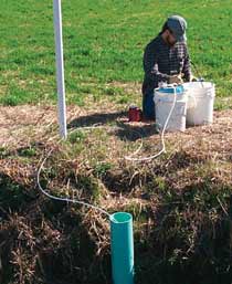 Data-collection activities at local and regional scales take advantage of new and developing technologies in data-collection tools and sample analysis methods.
Agriculture is the largest industry in North Carolina and accounts for 9.2 million of the State's 31 million acres of land. Tobacco is the primary crop, although it has been declining since 1997 (Benson, 2001). Other row crops include cotton, soybeans, corn, and wheat. Of these, cotton production has increased the most—by an order of magnitude over the last 20 years. Livestock (mostly poultry and hogs) accounted for 58 percent of farm receipts in 1999 (Benson, 2001). In the western part of North Carolina, major crops include orchards, Christmas tree farms, and trout farms. Western North Carolina is second only to Idaho in the production of farm-raised trout.
Agricultural practices present many environmental challenges to the State. Enormous quantities of nutrient-enriched wastes from poultry, hogs, and other livestock housed in large, confined, animal feed lots threaten ground- and surface-water quality. Waste lagoons generally are managed by periodically applying wastes to crops, and the lagoons are subject to leakage, inundation from flooding, and abandonment. The State lists 1,142 inactive animal-waste lagoons in 76 counties (North Carolina Division of Soil and Water Conservation, 2000). Large animal operations primarily are located in the Coastal Plain, where estuaries are sensitive to nutrient enrichment. Animal wastes also may contain traces of pharmaceuticals that, when delivered to ground and surface water, pose unknown risks to public health.
To support crop production, over 1.4 million tons of fertilizer was shipped to North Carolina in 2000. In addition, crops such as cotton and tobacco in eastern North Carolina and apples in western North Carolina require significant use of pesticides to maximize yields. Pesticides occur at moderately high concentrations in streams of the Coastal Plain (Spruill and others, 1998) and were present in Hurricane Floyd floodwaters (Bales and others, 2000), but little information is available on the occurrence of pesticides in surface and ground waters of the Blue Ridge.
Sediment derived from nonpoint sources remains the primary cause of impairment despite significant reductions in cropland erosion over the past 10 years (from 6.0 tons per acre per year in 1987 to 4.6 tons per acre per year in 1997; U.S. Department of Agriculture, 2000). Most of the research on the effects of agricultural best-management practices in North Carolina has been conducted in the Coastal Plain, where erosion and sedimentation is less of a concern than in the Piedmont and Blue Ridge. It is estimated that an average of 1.5 million tons of soil have been saved (retained on the land) annually between 1984 and 1997 as a result of installation of agricultural best-management practices. Documentation is needed of both the short and long-term effects of agricultural best-management practices on water quality, stream habitat, and biological communities through a reduction in sediment delivered to the stream.
Understand the hydrological, chemical, biological, and physical processes that determine the effects of agricultural practices on the State's water and aquatic biological resources.
 North Carolina's coast is a vital resource to the State and Nation. The State's 320 miles of beaches attract millions of visitors each year and are a leading reason that travel and tourism is the State's second largest industry. Inland coastal waters also are a tourist attraction for sailing, fishing, and sightseeing. North Carolina has 2.3 million acres of estuarine waters—more than any State on the Atlantic coast (Office of the Governor, 2000). The State has about 8,000 licensed commercial fishermen and more than 1.2 million persons fish recreationally in the estuaries, making North Carolina one of the top 10 States in the Nation in both commercial and recreational landings.
Nutrient loading, sedimentation, sea-level rise, and barrier island migration are equally important to the health and sustainability of North Carolina's coastal resources. More than 40 percent of North Carolina and 10 percent of Virginia ultimately drain to the Albemarle-Pamlico estuarine complex. Water exchange between the estuary and the ocean is restricted to three narrow and shallow inlets through the barrier island system known as the Outer Banks.
In contrast to other large estuaries such as Chesapeake Bay, the accelerated changes in the North Carolina coastal region is a late twentieth century phenomenon. 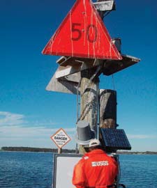 Recent conversion of watersheds to agricultural crops, intensive livestock, silviculture, and urban landscapes has greatly increased nutrient loading to North Carolina estuaries resulting in algal blooms, increasing eutrophication, fish kills, outbreaks of the toxic algae Pfiesteria piscicida, and the regular occurrence of hypoxia. The USGS and its partners have documented massive nutrient inputs to the system resulting from the passage of Hurricanes Fran (1996) and Floyd (1999). These inputs have had dramatic short-term effects on the estuaries, may have long-lasting consequences, and could be an indication of future conditions if Atlantic coastal storms increase as predicted (Paerl and others, 2001). Loadings of chemical contaminants, such as pesticides and veterinary pharmaceuticals, have resulted in exposures to chemical mixtures with unknown toxicological consequences.
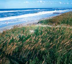
The health and function of the North Carolina sounds are intimately linked to the barrier islands. The Outer Banks protect shallow estuarine waters from harsh ocean conditions and provide a long residence time for assimilation of nutrient inputs and higher productivity. However, the long residence time also makes the sounds sensitive to excessive loadings of nutrients and other contaminants. Natural barrier islands are highly mobile, migrating in response to winter storms, hurricanes, and rising sea level. Storms overtopping barrier islands shift sand landward, reestablishing islands and providing sand critical to the maintenance of sound-side wetlands. The USGS documented a 300-foot landward migration of North Carolina's Outer Banks following a single hurricane. Natural barrier island migration is at odds with society's desire to protect valuable beach-front properties and stabilize economically important beaches. Most of North Carolina's beaches currently are retreating (eroding) in response to natural processes.
Barrier islands also evolve in response to the opening and closing of tidal inlets, which tend to migrate southward along North Carolina's coast. Inlet stabilization to maintain navigation and protect private property restricts the transport of sand, affects estuarine circulation and exchange with the ocean, and can restrict the movement of ocean-spawned larval fish into the estuary's critical nursery areas where the fish are protected and grow to adult life stages. 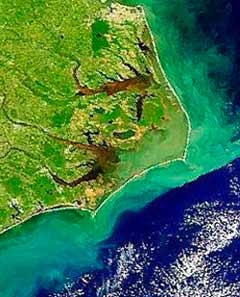
With partners, establish and operate an integrated monitoring network to document and understand coastal change across all important time scales and understand the geologic and hydrologic processes that are controlling change in the coastal system.
Millions of dollars are being spent in North Carolina to restore ecosystems and billions of dollars are being spent nationally to restore degraded ecosystems. The Clean Water Management Trust Fund in North Carolina supports land acquisition and other activities to maintain and restore aquatic systems.  As part of the North Carolina Wetlands Restoration Program (NCWRP), the State seeks to protect and improve water quality through restoration of wetlands and stream and riparian functions and values to achieve a net increase in wetland acreage, functions and values in all of North Carolina's major river basins, and to promote a comprehensive approach for the protection of natural resources. Riparian buffers are being required across the State, but effectiveness of these buffers is not well documented for settings outside the Coastal Plain. Stream-channel restoration is increasingly popular in North Carolina, with engineered solutions to streambank erosion and channel changes. "Cookbook" approaches to stream restoration, however, are increasingly seen as inadequate (Kondolf and others, 2001).
Good science is needed to provide objective integrated science for managers who are seeking to restore natural functions and values of aquatic systems. Integrated science for habitat restoration is valuable for defining the extent of environmental problems, and to distinguish between changes caused by management actions and natural changes caused by climatic shifts, environmental succession, and natural climatic variability. An understanding of aquatic ecosystem functions helps managers formulate possible solutions to problems. Predictive models can provide tools to help determine which proposed actions will be the most effective in resolving the problems. Finally, monitoring information is necessary to evaluate the effects of restoration efforts.
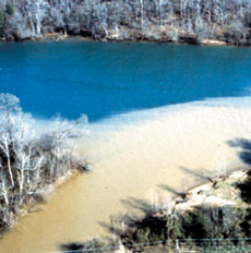 Provide relevant, high-quality, scientific information that permits resource-management agencies to improve the scientific basis for aquatic-habitat restoration decisions and to facilitate integration of scientific information relevant to restoration science.
A number of programs provide opportunities for the North Carolina District to assist with environmental monitoring and research in support of Federal initiatives, regulatory programs, and resource management. National parks in North Carolina include the Great Smoky Mountains National Park and Blue Ridge Parkway National Park in the west, and Cape Lookout and Cape Hatteras National Seashores on the coast. The Water-Quality Monitoring and Assessment Partnership provides opportunities for the USGS to assist the National Park Service in meeting its environmental management and monitoring goals. 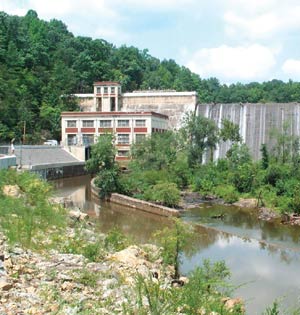 The studies in this partnership may be intensive studies to characterize known or suspected water-quality problems, synoptic studies that are short term and intended to provide quick assessments of conditions at specific locations or baseline data, fixed-station monitoring to document long-term trends, or technical assistance (U.S. Geological Survey, 2002).
The Southern Appalachian Man and the Biosphere (SAMAB) Program, established in 1988, is a cooperative program of 11 Federal agencies, including the USGS, 3 States, and a foundation of university and private sector interest that promotes environmental health, stewardship and sustainable development of natural, cultural, and economic development in the southern Appalachian region. Among the goals of SAMAB is to understand and describe the status and dynamics of the natural resources and benefits of ecosystem management and sustainable development. In addition, the USGS is seeking partners for a Southern Appalachian Critical Ecosystem Program to identify and collaborate on resource issues in the area.
The Clean Water Act includes requirements for the State to develop strategies for managing stormwater runoff and establishing TMDLs for waterbodies in the State that do not meet water-quality standards. Pollutants, such as fecal coliform, suspended sediment, mercury, and nutrients, are among the causes of impairment identified by the State on the 303d list (North Carolina Department of Environment and Natural Resources, 2000). The role of ground water as a contributor to water-quality impairment has generally been ignored, but could be important in some areas. A report by the National Research Council (2001d) points to careful collection and interpretation of monitoring data as the key element for effective TMDL development. Establishing TMDLs requires access to and compilation of water-quality data, water-quality monitoring, and predictive modeling and trend analysis of streamflow and water quality.
The Federal Energy Regulatory Commission (FERC) licenses and inspects private, municipal, and State hydroelectric projects and oversees environmental issues related to hydroelectric power generation. Many hydroelectric facilities in North Carolina are in the process of applying for relicensing by FERC and need data on streamflow, tailwater flow and water-quality conditions, and reservoir hydrodynamics and water quality.  Moreover, the effects of dams on tailwater channel morphology has received little attention in North Carolina but is an important issue with regard to aquatic habitat.
The USGS traditionally has provided streamflow data required by the National Weather Service (NWS) to issue flood forecasts and to calibrate flood forecast models. A recent initiative by the USGS, NWS, and the North Carolina Floodplain Mapping Program is to provide real-time flood and flood-warning information in easy-to-understand graphical displays. The USGS has the technical expertise to provide enhanced flood information by using USGS water-resources and geographical information and by application of two-dimensional unsteady flow models.
Flooding from Hurricane Floyd in 1999 brought to public attention issues related to water quality and public health. Such issues include the effects of animal-waste lagoon inundation and flooding on the quality of drinking water in domestic wells, the effects of flooding on the spread of waterborne pathogens, and the occurrence of harmful algal blooms in nutrient-enriched coastal waters. These public-health issues have been the domain of the Centers for Disease Control and Prevention (CDC) and the National Institutes of Health (NIH), including the National Institute of Environmental Health Sciences (NIEHS). The District developed contacts with NIEHS after 1999 and shared expertise needed to link these public-health issues with environmental processes.
Support Federal and State programs for the management of natural resources, regulatory control, and process research with hydrologic and water-quality monitoring and modeling.
USGS scientists must define and explain science's societal payoffs if they are to continue to be funded. Fortunately, the agency has a long history of close links between research and social issues. (National Research Council, 2001a)
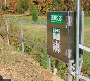 The USGS is the Nation's lead scientific agency in the collection of water data and the dissemination of water-resources information. Timely information transfer is increasingly important for both data and research results. For example, with the advent of the Internet, water-data customers of online data have grown to be the USGS's strongest users and advocates. The North Carolina District will take the following actions to improve and expand the transfer of data, study results, and technology to customers and partners:
The Nation needs an independent agency that is separate from regulatory agencies to collect, develop, archive, and provide continuous, reliable data, information, and cohesive knowledge about the Nation's water resources. Unique among Federal natural-resource agencies, the USGS has no regulatory function or advocacy role but is purely an earth science and information agency.  Although many Federal agencies conduct or manage some aspect of river science studies, the USGS stands alone in its ability to conduct comprehensive research and assessments of the Nation's water resources. The USGS can uniquely implement interdisciplinary water-resources science programs that have regional, national, and global perspectives. The ability of the USGS to integrate geologic, hydrologic, geographic, and biological databases through new information science capabilities provides unparalleled opportunities to translate good science into useful and usable information.
The USGS, however, cannot accomplish the science goals outlined in this report alone. Strong and effective collaboration among scientists in the USGS and other Federal agencies, State and local agencies, and in the academic community is required. The USGS science activities must be consistent with and integrated into the agendas for hydrologic and ecological sciences established by the local and worldwide scientific community.
To achieve the science goals set forth in this report, the North Carolina District must maintain and strengthen existing partnerships, build new relationships in the scientific community, and identify new customers for USGS data and information. Specifically, it is the goal of the North Carolina District to
"Organization doesn't really accomplish anything. Plans don't accomplish anything, either. Theories of management don't much matter. Endeavors succeed or fail because of the people involved. Only by attracting the best people will you accomplish great deeds." (General Colin Powell, 2001)
People are the most valuable asset of the USGS and will remain so in the future. The success of the North Carolina District in achieving the science goals outlined in this report depends on the ability of the USGS to hire top-level scientists who are excited about the USGS mission and who are allowed to work in an environment that recognizes and rewards creativity, innovation, interdisciplinary collaboration, and productivity.  The ability to recruit and maintain high-quality scientific and support staff depends on identifying ways to reward creative and resourceful personnel. A long-term commitment by the USGS leadership to a robust and focused research strategy, with the necessary supporting infrastructure, should encourage scientists to make a similar commitment to the USGS goals and reduce turnover, while encouraging new scientists to join the USGS.
In order to maintain and enhance the USGS workforce, the North Carolina District will endeavor to:
Return to the |
|
| AccessibilityFOIAPrivacyPolicies and Notices | |
 |
|