South Atlantic Water Science Center - North Carolina Office

CURRENT CONDITIONSCurrent streamflow conditions in North Carolina.
DATA CENTER
USGS IN YOUR STATEUSGS Water Science Centers are located in each state. 
|
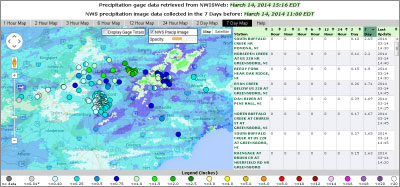
Interactive Real-Time Data Maps
These interactive maps are provided as a geographic interface to water data from about all USGS real-time data sites in North Carolina. Data Sources Site locations and current data are from the National Water Information System (NWIS). National Weather Service precipitation overlays, used in the Real-time Rainfall map, are provided by the National Weather Service. The images are available at http://www.srh.noaa.gov/ridge2/RFC_Precip/. Other USGS water data maps |

![]() U.S. Department of the Interior |
U.S. Geological Survey
U.S. Department of the Interior |
U.S. Geological Survey
URL: https://nc.water.usgs.gov/realtime/index.html
Page Contact Information:
North Carolina Web Development Team
Page Last Modified: Tuesday, 02-May-2017 14:34:31 EDT